Christine Walks the Pennine Way - Part 2
Read all about the second half of our excellent walk along the Pennine Way.
Christine Walks the Pennine Way - Part 2
https://www.contours.co.uk/christines-pennine-way-adventure-part-2
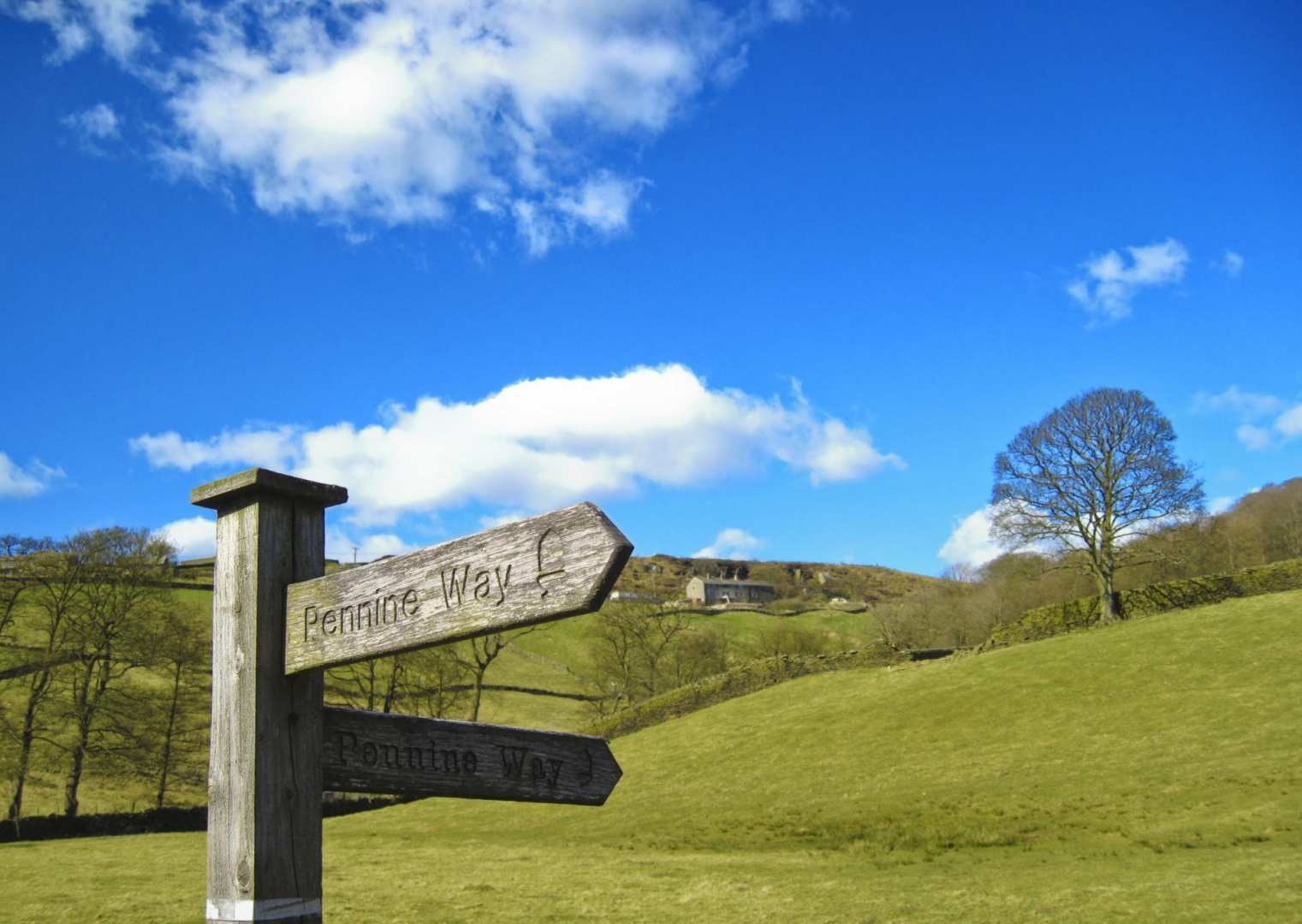
Here is my continuing diary for the next five days of my amazing Pennine Way journey; covering the central section of the trail from Horton-in-Ribblesdale to Alston. After a fabulous week of dry weather, my luck was about to run out! Follow this link for part 1.
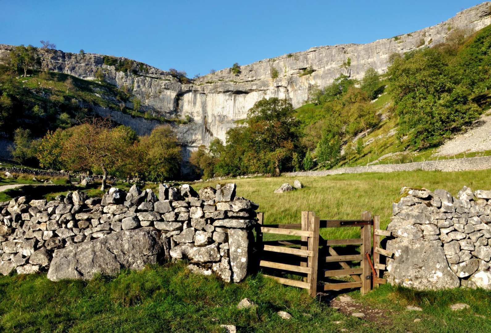
After two fantastic days of walking with great variety, today I found the trail a bit tedious. It was easy walking but hard on my feet and legs, walking along hard surfaced tracks. The first 11 miles followed a selection of tracks - old packhorse tracks, dirt tracks, tarmac tracks, gravel and stone tracks - even though I'm not a big fan of walking along long stretches of track, I don't mind short stretches so much. They're OK if you wish to get a stride on and cover big distances quickly, but I do find them monotonous. Having said that, I did enjoy the day and it was another warm sunny day once the clouds had burnt off.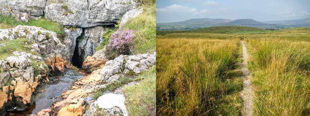
From Horton, the trail ascended up a stony track passing Sell Gill Holes; I was now in pot-holing and caving country, and a small group of cavers were aiming for Sell Gill behind me. Just beyond here, the Yorkshire Three Peaks route joined the Pennine Way for just under half a mile. A group of Three Peakers joined the trail just behind me: noisy gabblers! I could have chatted to them but didn't, and they didn't attempt to talk to me; they were all too busy comparing stories of all the 'challenge' walks, triathlons, races etc. that they had done. They soon disappeared off to the left and I had peace on the trail again. I enjoy walking alone, enjoying the peace and tranquillity and I love the feeling of having the hills and trail all to myself; it's very uplifting. Not that I'm adverse to walking in company - I enjoy that too, especially for shorter walks, but for a long distance trail I prefer to walk alone at my own pace, stopping - usually only briefly - and starting when I want. Apart from the group of Three Peakers, I didn't see another walker all day.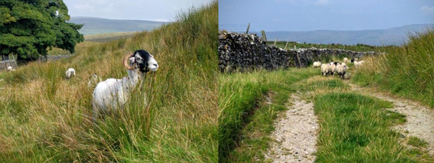
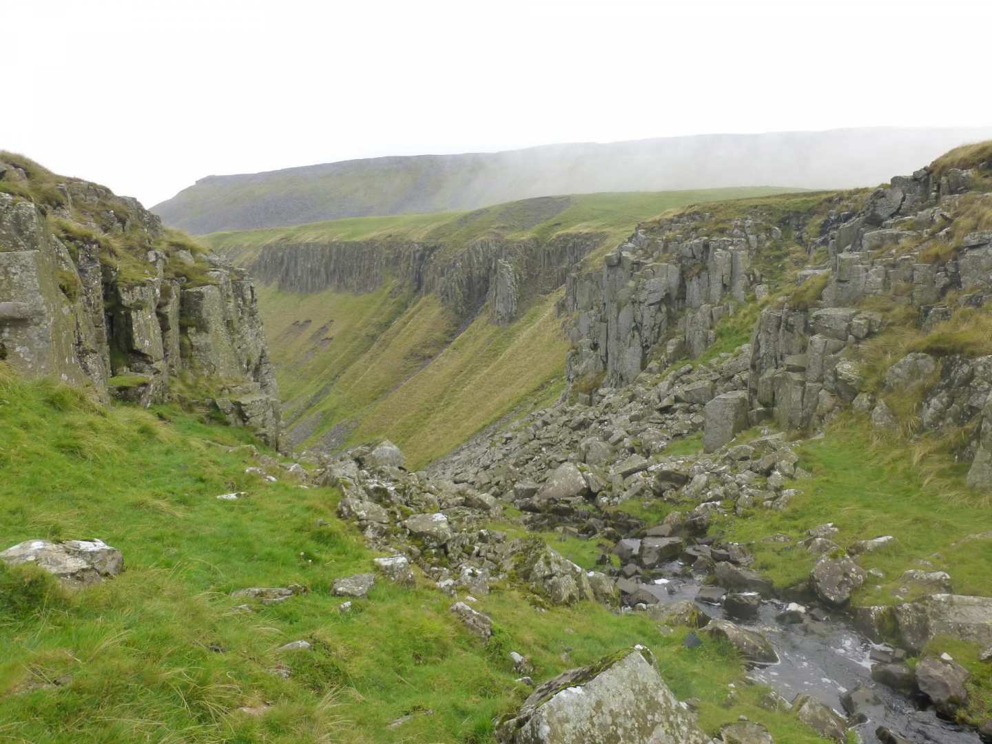
I passed another pot hole (Calf Holes) heading towards Ling Gill, where I crossed a very old packhorse bridge dated 1765.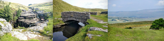
From here the trail continued gradually uphill to Cam End, with a hazy view of Ribblehead Viaduct.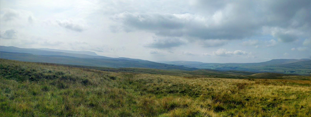
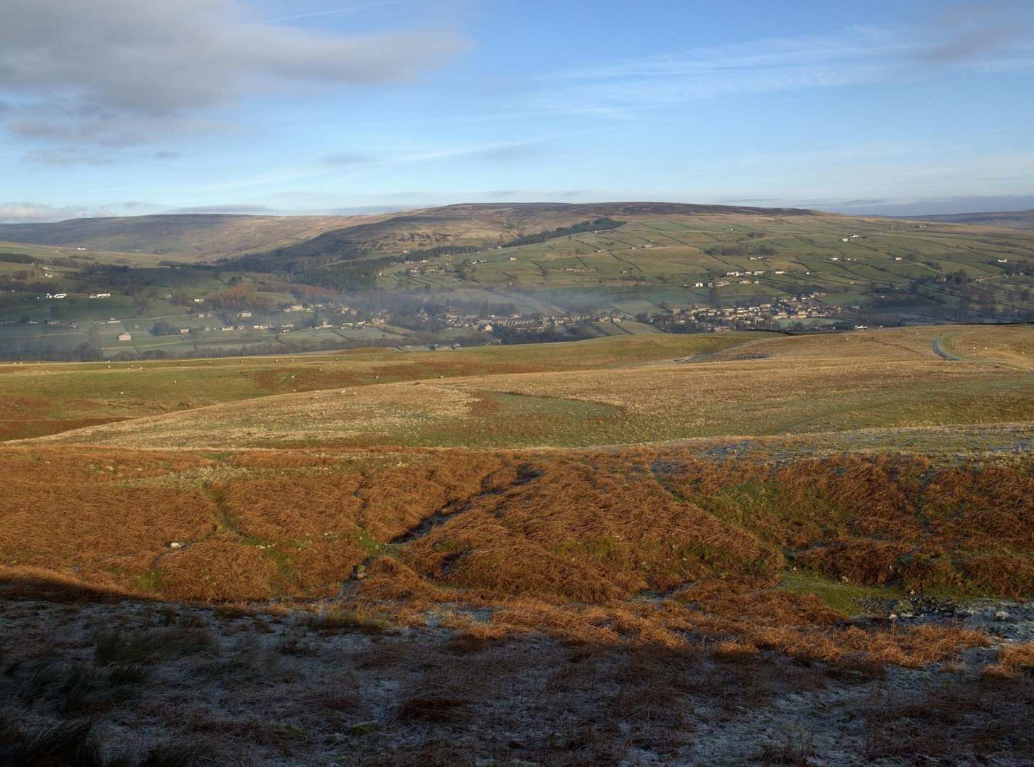
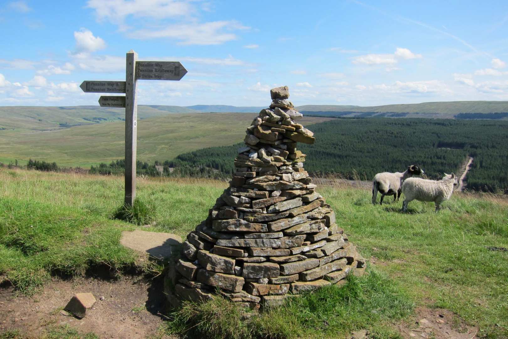
At Cam End, the Dales Way joined the Pennine Way along Cam High Road - once an old Roman road but now an ugly gravel logging road - before turning off east just under a mile further on by the almost perfectly-shaped conical cairn.
The sun was just starting to break through, creating great shadows of myself on the now tarmac track. The tarmac track eventually joined West Cam Road, an old drove road above Snaizeholme valley; unfortunately the views were constantly blocked by a stone wall.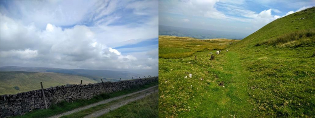
Eventually the trail left the walled tracks behind and reached Rottenstone Hill, and a nice grassy path descending to Hawes. A refreshing change of terrain!
Hawes is a pretty market town - the highest town in England - and another very popular tourist town; it was heaving with people on a very warm sunny day. I'd been craving an ice cream all the way there, so I found an ice cream stall selling locally-made vanilla ice cream (yum yum!) and sat for a while watching the world go by.
.jpg)
I still had a further mile and a half to go as I was finishing in Hardraw today, not Hawes, but a lot quieter than Hawes! It was a lovely walk from Hawes through Wensleydale, over the river Ure and through meadows to Hardraw. I stopped in the cafe for a cup of tea and some well earned fruit cake with Wensleydale cheese; a must eat when in Wallace and Gromit country!
I went to the Green Dragon Inn in the evening to eat; a 13th century coaching inn and home to Hardraw Force Waterfall, though you have to pass through the pub to view it. The interior of the pub was impressive and characterful with flagged floors, old fire places and many original features. Here I met another couple who were also walking the Pennine Way - a lovely couple who I continued to meet regularly from then on, all the way to end.
My luck with the weather ran out today: after a full week of dry weather it was a cloudy day today with heavy rain forecast for the afternoon, so I opted for an early start - 7:40am - to try and avoid the worst of the weather. Leaving Hardraw, it was back onto an old track again, gradually ascending heading for Great Shunner Fell, Yorkshire's third highest mountain four and a half miles away. The higher I got the cloudier it became - I wasn't going to get good views today!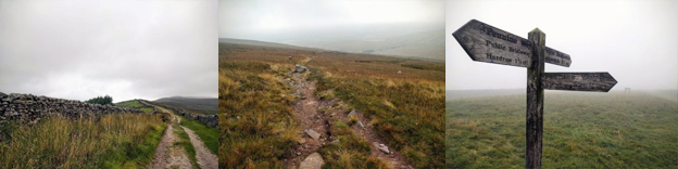
By the time I reached the summit, visibility in the cloud was quite poor and it became very windy; luckily the path was clear and defined and lots of cairns led the way. There was a large stone shelter on the summit to shelter from the wind.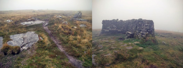
It was a gentle descent from the summit and it wasn't long before I was below cloud level again; I was now heading for Swaledale and the small village of Thwaite. If it had been a nice day I would have stopped at the cafe in Thwaite, but with rain imminent however I decided to push on.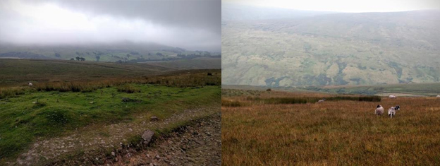
From Thwaite is was uphill again, up around Kidson Hill; I really enjoyed this section of path towards Keld as it was far more interesting, with lots of variety, lots of overgrown bracken, a bit more of a challenge and a welcome change after all the track walking. The path was rocky in sections, passing through some rock fall areas.
There were also lovely views down into the valley below. I passed a couple of Pennine Way walkers who were walking the trail north the south - they lived in Manchester and so were walking home!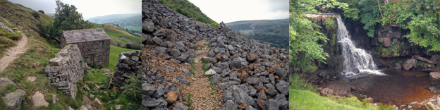
The path crossed the River Swale and past some falls; I remembered these falls from walking the Coast to Coast Walk, which also passes through Keld.
I didn't walk into Keld itself where there was another cafe, again pushing on instead and hoping to beat the rain. My luck ran out not long after leaving Keld!
I still had another 4 miles to go to reach Tan Hill Inn. The trail climbed up out of Keld along a walled track which eventually opened out onto moorland over Stonesdale Moor. I'd just reached the moorland section when it started raining, so I stopped and sheltered behind a wall to put on my waterproofs. The rain was light to start but then turned into heavy, driving rain on top of the moor in the wind. I marched on: I actually don't mind walking in the rain, I find it quite refreshing - initially anyway - but perhaps not after a whole day! I ended up walking in the rain for just over an hour before I reached Tan Hill Inn, where I was staying for the night.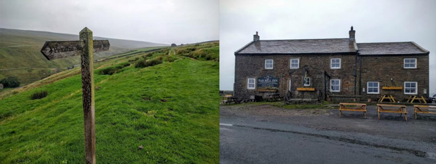
Because I'd arrived so early my room wasn't ready, so I ordered some tea and cake whilst I waited. An hour later I got into my room, the radiators were turned up and my clothes dryed out. Later I returned to the bar for dinner and found the couple I'd met at Hardraw sat drying off next to the fire so I sat and chatted with them for a while, plus another young lad, who I had met previously, whose walking partner dropped out at Hawes due to tendonitis.
I had a lovely cooked breakfast at Tan Hill Inn which set me up for the day. I needed it today as it was a wet one; within 5 minutes of leaving Tan Hill Inn, it started raining.
On the advice of the inn landlord, I opted for the bad weather 'alternative route' rather than risking getting stuck in the bog on Sleightholme Moor. He had lots of 'true' horror stories of people getting stuck in the bog: the most recent rescue including someone immerged in the bog up to their neck! The alternative route went along the road and descended Sleightholme Moor track avoiding the worst of the bog, rejoining the official Pennine Way on a track leading up to Wytham Moor. Luckily on a bad weather day, the trail was fairly easy going and consisted of a few smaller ascents and descents rather than bigger climbs.
The rain stopped briefly for about an hour whilst I was walking up and over Wytham Moor and down to the A66. Here, a new underpass had been built, avoiding the need to cross the busy road. Just before the underpass I passed a sheep with some amazing, perfectly spiralled horns.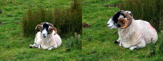
Just after I crossed the A66 the rain returned, this time for good; with light rain to start with but then turning heavier, it was set in for the rest of the day - hence why there are not many photos for today!
Next, it was up and over Bowes Moor, passing a shooters hut which had an inbuilt shelter for walkers.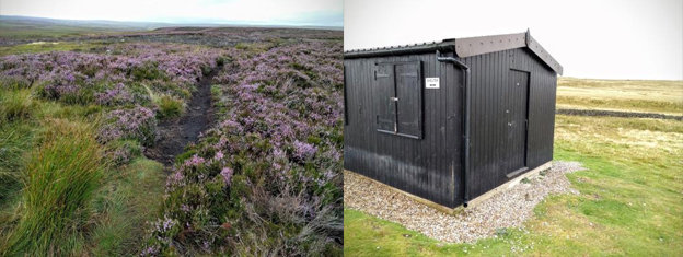
Another up and over, this time over Cotherstone Moor and the trail reached Baldersdale, the halfway point!
The trail passed Blackton Reservoir and headed over Mickleton Moor, where I passed a couple of south-bound Pennine Way walkers sat tucked behind a wall eating their lunch, whilst attempting to shelter from the wind and rain. The trail continued onto Grassholme Reservoir and Lunedale. One final up and over Harter Fell and I arrived in Middleton-in-Teesdale, very wet.
I headed into Middleton-in-Teesdale itself, just off the trail, to the Teesdale Hotel. The receptionist guy kindly offered to put all my wet waterproofs and boots in their boiler room overnight to dry. There was some great food in the bar there in the evening also.
Another 'favourite day' today, with lots of highlights and lots of waterfalls; it couldn't have worked out better, the best time to see them is definitely after a day of very heavy rain!
After yesterday, it was lovely to wake up and see blue skies again. The weather today, although it stayed dry, was constantly changing between black clouds and blue skies, which was quite dramatic.
The first few miles from Middleton-in-Teesdale followed alongside the River Tees through farmland before reaching a double waterfall, Low Force. This was the smallest of three waterfalls today, with each one getting more impressive! Low Force was pretty impressive, especially after all the rain.
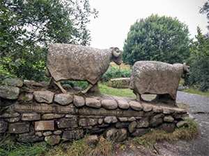
Near Low Force there was a pair of stone carved rams, the saying on one side said: "A WONDERFUL PLACE TO BE A WALKER" I agree!
A further mile along the river was the even more impressive High Force, a 70ft high waterfall, and indeed very powerful; it was not possible to get a photo from below the falls as it was too dangerous, without making a big detour back, across a bridge and back up to the other side of the river near to High Force Hotel, so I had to make do with one from the top of the fall.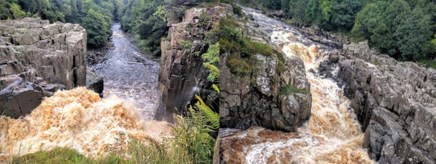
Leaving High Force, there was a boot wash and disinfecting station. The area has lots of juniper bushes which were under threat from a tree killer disease, which can be spread by footwear and animals.
After High Force the trail continued beside the river, and then briefly moved up onto open fells before dropping back down to a junction of the River Tees and Langdon Beck. A brief 1/4 mile walk alongside Langdon Beck follows before it goes back across the fell to rejoin the River Tees. Here the scenery was amazing with the dramatic skies helping, following the river valley past Cronkley Scar on the opposite side.
A bench appeared with views down the valley, making for a lovely snack stop. The trail then continued, following alongside the River Tees and reaching an area of rock falls at Falcon Clints, which required careful treading over the jumbled rocks and boulders. I'm glad they were dry and not wet, as they would have been very slippery.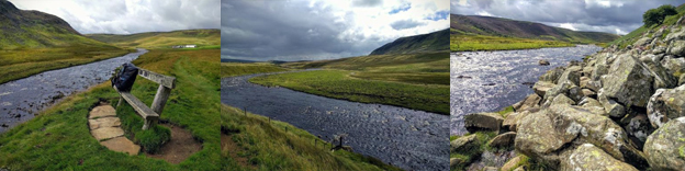
Just after here I had my first fall. A couple of planks of wood were laid across a boggy section; they looked stable so I marched on, only for them to collapse under me. I ended up on my knees in the bog!
Hiding around the corner was the final and most impressive waterfall of the day, Cauldron Snout.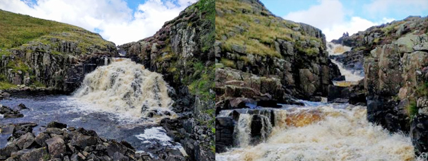
To get to the top of the falls required a climb and scramble up the right hand side, alongside the gushing gully of the falls.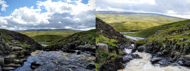
At the top of the falls was Cow Green Reservoir hidden behind a dam wall. From here the trail continued through Birkdale Farm, said to be the highest occupied farmhouse in England which earned fame in the 1970's as part of a TV documentary called "Too Long A Winter".
The next section was a bit of a spoiler after a perfect day so far; a few miles' slog ascending what appeared to be a recently laid gravel track alongside military land, before turning off back onto fell land again down to Maize Beck. Crossing Maize Beck, the trail continued through the valley, suddenly arriving at High Cup (Nick) and the final highlight of the day.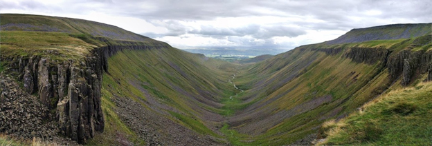
The result of glacial erosion, High Cup (Nick) is a truly impressive natural amphitheatre, and I'm so glad it was a good weather day today.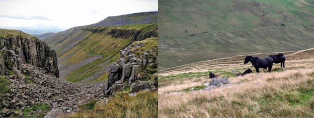
The trail left via the north edge of High Cup and then followed an old miners' track, passing some wild horses, before descending the last four miles to the small village of Dufton.
It was a very wet start to the day today - it rained heavily throughout the night and was still raining heavily when I set off walking this morning - not the best weather day to be climbing up to Cross Fell, the highest point on the Pennine Way. Leaving Dufton, the trail ascended gradually up what would normally be a track; today however, it had turned into a stream! At the end of the track the trail continued, ascending up the grassy hillside towards Knock Fell, gradually getting steeper and heading into the clouds. The rain did eventually ease, but it continued to be very wet underfoot and tough going.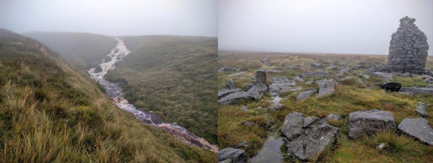
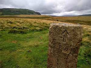
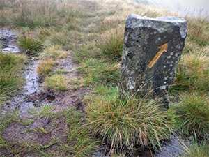
Visibility became poor in the drizzle and cloud. Luckily the trail did have guide posts and cairns to lead the way to a large cairn, Knock Old Man, just before reaching the summit of Knock Fell. I passed a stone Pennine Way marker painted gold; I assumed it was painted gold to mark the 50th anniversary of the Pennine Way last year.
After Knock Fell, the trail continued to briefly meet an access road up to a radar station; the large white dome of the radar station would normally be a good navigational tool, guiding walkers to Great Dunn Fell, but not today though. Here I caught up with another couple of Pennne Way walkers and continued walking with them over the next summit, Little Dunn Fell, and finally to Cross Fell. Slabs made the walking slightly easier, but some were quite smooth and so very slippery in the wet, and I went flying on one, luckily tumbling and landing on soft grass.
Cross Fell at 2930ft is the highest point on the Pennine Way and in England outside of the Lake District. There is a large cross-shaped stone shelter on the summit which was rebuilt last year, again for the 50th anniversary of the Pennine Way.
Finding our way off Cross Fell following cairns, it was downhill to join a track called Corpse Road, which soon lead to Greg's Hut, an old miners hut which is now a bothy and refuge for walkers, and very welcome on days like today. Just as we rounded the corner however and Gregs Hut came into view, the clouds also cleared and there was some sunshine on the other side; the weather looked promising for the afternoon!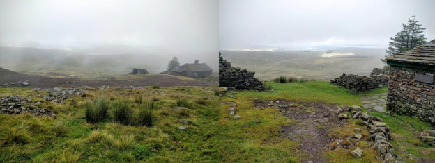
I stopped for a short break at Greg's Hut and was very relieved to be able to remove my waterproof jacket and trousers, knowing I would be able to dry off on my descent from Greg's Hut, I was soaked through to my underwear from sweat, not the rain! I left Matt and Sarah behind cooking up some lunch and continued on.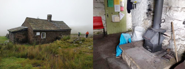
The next 7 or so miles followed the Corpse Road (a stoney track) all the way down to Garrigill. There was sunshine in the distance but looking back, Cross Fell remained in the cloud with a distinct line of division between cloud and clearer skies, with Greg's Hut being the marker line. It only took about half an hour of walking in the sunny spells to dry out, which was such a relief.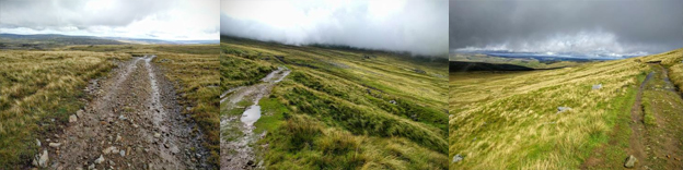
From Garrigill it was a further 4.5 miles via riverside and field paths onto Alston, England's highest market town with plenty of services and pretty cobbled streets.
Contours Holidays pride ourselves on our expert knowledge of the UK’s trails. We regularly set out to check our routes and directions and to make improvements on the holidays we offer. You can find several write-ups of staff expeditions in our Trail Diaries.