Christine Walks the Pennine Way - Part 3
Christine's Pennine Way Adventure heads for the Borders and crosses over into Scotland, all the way to the finish line at Kirk Yetholm.
Christine Walks the Pennine Way - Part 3
https://www.contours.co.uk/christines-pennine-way-adventure-part-3
It was a very wet start to the day today - it rained heavily throughout the night and was still raining heavily when I set off walking this morning - not the best day to be climbing up to Cross Fell, the highest point on the Pennine Way. Leaving Dufton, the trail ascended gradually up what would normally be a track; today however it had turned into a stream! At the end of the track the trail continued ascending up the grassy hillside towards Knock Fell, gradually getting steeper and heading into cloud. The rain did eventually ease, but it continued to be very wet underfoot and tough going.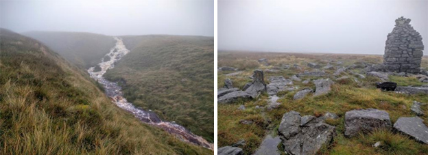
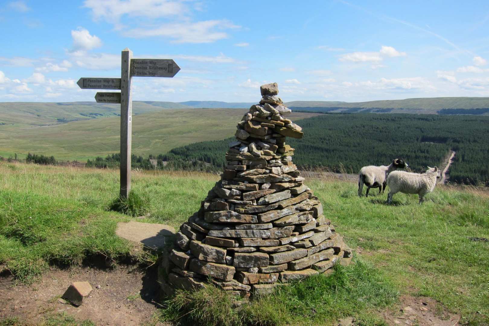
Visibility became poor in the drizzle and cloud. Luckily the trail did have guide posts and cairns to lead the way to a large cairn, Knock Old Man, just before reaching the summit of Knock Fell. I passed a stone Pennine Way marker painted gold; I assumed it was painted gold to mark the 50th anniversary of the Pennine Way last year.
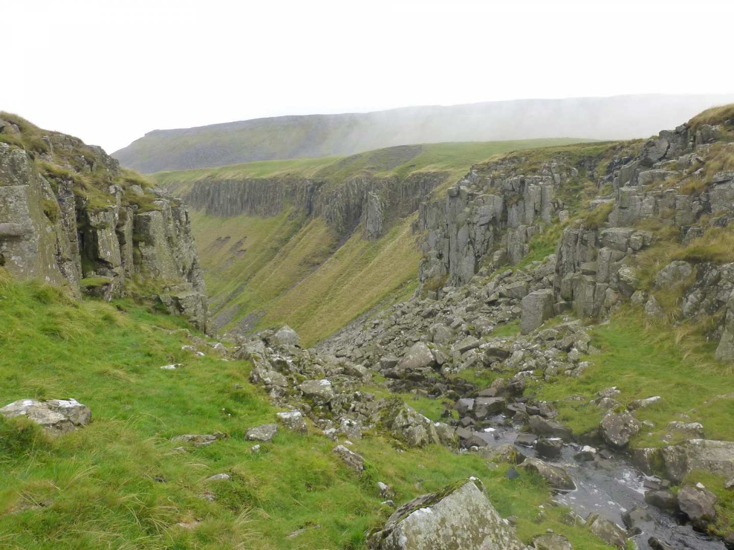
After Knock Fell, the trail continued to briefly meet an access road up to a radar station - the large white dome of the radar station would normally be a good navigational tool, guiding walkers to Great Dunn Fell, not today though. Here I caught up with another couple of Pennne Way walkers and continued walking with them over the next summit, Little Dunn Fell and finally to Cross Fell. Slabs made the walking slightly easier, but some were quite smooth and very slippery in the wet and I went flying on one, luckily tumbling and landing on soft grass.
Cross Fell at 2930ft is the highest point on the Pennine Way and in England outside of the Lake District. There is a large cross-shaped stone shelter on the summit which was rebuilt last year, again for the 50th anniversary of the Pennine Way.
Finding our way off Cross Fell following cairns, it was downhill to join a track, Corpse Road, which soon lead to Greg's Hut, an old miners hut, which is now a bothy and refuge for walkers, and is very welcome on days like today. Just as we rounded the corner however and Gregs Hut came into view, the clouds also cleared; there was some sunshine on the other side, the weather looked promising for the afternoon!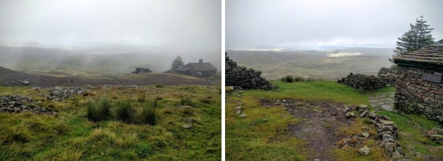
I stopped for a short break at Greg's Hut and was very relieved to be able to remove my waterproof jacket and trousers, knowing I would be able to dry off on my descent from Greg's Hut. I was soaked through to my underwear from sweat, not the rain. I left Matt and Sarah behind cooking up some lunch and continued on.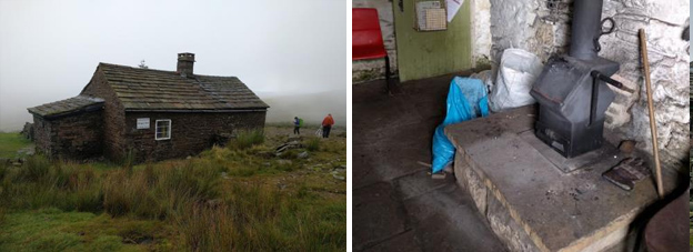
The next 7 or so miles followed the Corpse Road (a stone track) all the way down to Garrigill. There was sunshine in the distance but looking back, Cross Fell remained in the cloud with a distinct line of division between cloud and clearer skies, Greg's Hut being the marker line. It only took about half an hour of walking in the sunny spells to dry out, which was such a relief.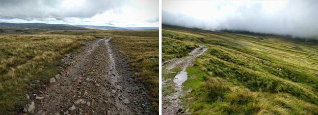
From Garrigill it was a further 4.5 miles via riverside and field paths onto Alston, England's highest market town with plenty of services and pretty cobbled streets.
It rained during the night but by morning it was dry, cloudy to start off, but then warm and sunny again later on. Departing Alston there was a choice of trails; follow the easier South Tyne Trail, which is also a slight short cut, along a disused railway or continue along the Pennine Way. Being a traditionalist I opted for the Pennine Way, while others took the short cut. It was quite wet underfoot in places, and with lots of long wet grass after the overnight rain, my gaiters were on and off a few times today.
The trail passed the site of an old Roman Fort, Whitley Castle, which had links to Hadrian's Wall. Continuing through fields I had views of the South Tyne Heritage Railway, England's highest narrow gauge railway, and train and carriages at a standstill on the track, which were obviously not running today. The trail continued through the hamlet of Slaggyford under an old viaduct onto Burnstones near Knarsdale. I did accidently join the South Tyne Trail instead of following the Pennine Way just after Slaggyford, for about half a mile before rejoining the Pennine Way at Burnstones, passing a group of large rams on the way on the disused railway trail.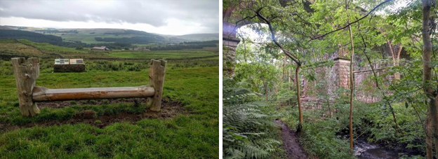
From Burnstones the trail climbed following an old Roman Road, dropped down to Glendue Burn and then up and over again to Hartley Burn. I went wrong here again, missing a right turn and continuing across a field to a lane. Luckily I just got out of the field as the farmer returned with a full load of muck to spread on it! Realising my error I wasn't going to risk walking back over the field again and getting covered in muck; I had seen a path running parallel to the field on my map just up the lane that lead me back to the Pennine Way, so opted for that safer option instead. Back on track the trail got gradually boggier as the afternoon went on, crossing Round Hill and Blenkinsopp Common where the trail disappeared for a while, so I just made my own route across the boggy grass to join a fence line and a defined trail again. Next it was up and over Black Hill where the bog got worse! After descending Black Hill the bog disappeared, the trail dried up and it was back walking on nice grass again. The trail continued crossing the busy A69, across a golf course and eventually arriving at Thirlwall Castle on Hadrian's Wall Path.
The first 9 miles of the Pennine Way today followed a section of Hadrian's Wall Path, an extremely popular trail along the famous and historic World Heritage Site that draws the crowds, so I wanted an early 8am start. I had the trail to myself for the first hour and a half, but then it got busy! It was a hot sunny day, cloudy to start but by as early as 8:30am it became very hot.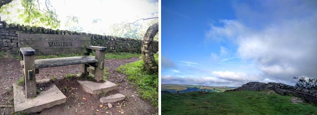
The trail passed though Walltown Quarry and climbed up to Walltown Crags to follow the line of the wall. This section of the trail is a bit of a rollercoaster, with lots of short, steep ups and downs. I walked the whole of Hadrian's Wall Path last year I so was familiar with this section of the trail.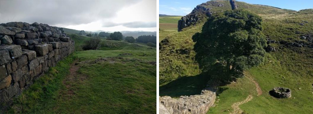
The trail passed a lone Sycamore tree next to a round stone circle, the iconic tree known for appearing in Kevin Costner's film, Robin Hood Prince of Thieves and probably the most photographed tree in England. Not long after here I reached Rapishaw Gap where the Pennine Way left the hustle and bustle of Hadrian's Wall Path and headed north; peace again on the trail.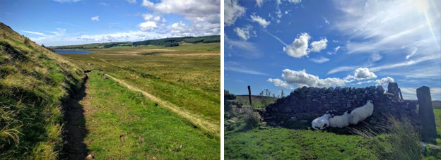
After open grass and farmland the trail entered Wark Forest. Following gravel tracks through the forest, I was hoping for some shade but the tracks were too wide so still in full sun. The trail did wander off the track eventually onto boggier paths heading towards Stonehaugh.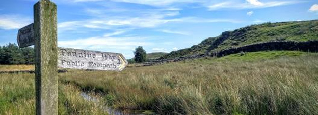
There was a small diversion in the forest here to avoid an eroded section, before rejoining the trail and heading out of the forest back across farmland. I was getting very low on water at this point and could see from my map that a stream was ahead, Warks Burn, where I had planned on topping up my water as I had a small water filter with me. Just before the stream however I saw a sign saying 'honesty box at farm at top of hill' - perfect timing!
Horneystead Farm 'Pit Stop' it had everything a walker needed - cold drinks, water, snacks, tea/coffee, toilet, shower. The owner was a previous PCT (Pacific Crest Trail) thru hiker, and these very welcome set ups for hikers are often found on American long distance trails. There were tables and chairs outside so I took my boots off to let my feet air, though the owner's daft Westie dog kept trying to steal my smelly socks! I bought a can of pop and filled up my water. The pop kept me going all the way to Bellingham, still a few miles away through fields and a brief scramble up Shitlington Crag, before finally dropping down to walk along the B6320 into Bellingham. In the evening I had a lovely meal at the Cheviot Hotel; the best Hunters Chicken I've ever eaten!
Today was my least favourite day on the trail, although I still mainly enjoyed it. It was cloudy all day, walking in damp low cloud, just one short light rain shower - it was very wet underfoot all day. No views today either!
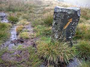
The trail climbed gradually out of Bellingham initially on grassland, but then through very narrow paths across overgrown heather moorland heading towards Deer Play and Whitley Pike. The heather was very damp and wet and just the right height to soak the bottom of your trousers through, and eventually the wet also got into my boots - the first time I've got my boots wet on the inside! I passed a moss-ridden old Pennine Way sign, which also gave the impression it was often damp on this section.
I went wrong a couple of times today, as the trail was very indistinct through the heather. At one point I caught another couple of walkers I'd met previously; while chatting and not concentrating, we all set off on the wrong path. We realised our mistake after about quarter of a mile and headed back the way we'd come and then 'off-piste' to join the correct trail again. Down off Whitley Pike and around Padon Hill the trail was slabbed for a while, a short respite from the wet undergrowth, until the trail climbed steeply at Brownrigg Head before entering Redesdale Forest. Here the trail went through wet, waist-high bog grass, so my trousers got even more soaked. Once at the top it was another wet slog through cleared forest, about a mile and a half of very wet squelchy boggy ground; for once it was a relief to reach the forest track.
There were some lovely areas in this wet forest, full of dew-covered cobwebs and bright red mushrooms.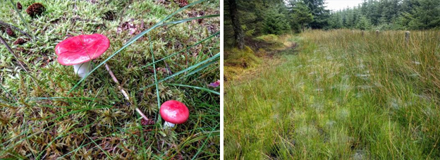
It's a good job no other walkers had caught me up or were close behind me, because as soon as I reached the forest track I took off my sodden trousers to wring them out - not a pretty sight - followed by my socks! I didn't worry too much about my boots getting wet today as I knew I was staying at a B&B with a drying room.
The forest track continued for three miles down to Blakehopeburn car park and toilets on the northern edge of Kielder Forest. From here the trail followed forest and riverside tracks to Byrness. I passed a retired gentleman, a Volunteer Park Ranger whose job for the day was to count all the Pennine Way walkers passing through; I was the first person he'd seen so far that day! I think he was a bit lonely and wanted to talk for ages, but I just wanted to get to my B&B and dry off. Byrness is a bit of a strange place; I had to double check I was walking in the right direction along the road to get to my B&B as it seemed like I was heading into nowhere. I arrived at Forest View B&B at 3pm, a sign said they opened/check-in was at 4pm but also said to help yourself to tea/coffee laid out in the conservatory while waiting. I also spotted the drying room so got my wet boots in there straight away to start drying off. A real walkers B&B, very comfortable with a good menu to choose from for evening meals, and all home cooked. You share tables and dine with other walkers, and there was a nice bunch also staying, including a chocolate Labrador who made me miss my beloved choc lab Bella, who's too old to walk the Pennine Way now.
Another favourite day! Fantastic weather again for my penultimate day's walking in The Cheviots; warm and sunny with clear views. Some walkers attempt to walk the final Cheviots stage in one day as there is nowhere to stay half way, but this would be an extremely tough and long slog. To overcome this problem however the B&Bs in Byrness & Kirk Yetholm offer to pick up walkers from the closest pick up point, which is 2 miles off the trail at the half way point, and ferry them back for a 2nd nights stay, then drop you back off again in the morning. There were six of us, plus the choc lab, staying at the B&B who availed of this option, so we all set off walking from the B&B together and stuck together for most of the day. We were all getting picked up together at the same time, so there was no point in anyone or me racing off, and it was a refreshing change to be walking in a group and taking my time, with a casual slower approach to today. We also bumped into other PW walker friends just leaving Byrness, so there was a huge group of us!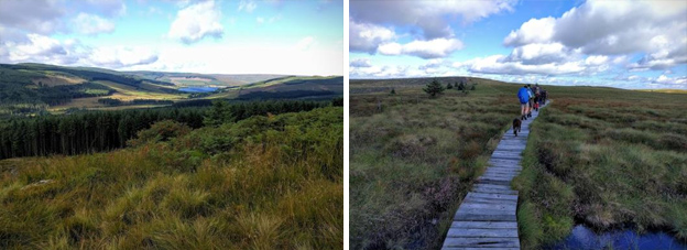
It was a steep climb out of Byrness up to Byrness Hill, but it was worth it for the views at the top. The trail continued over Houx Hill and Ravens Knowe on a selection of trail surfaces, slabs and duckboards, to cross the border temporarily between England and Scotland near Coquet Head.
The trail passed Chew Green, the remains of an old Roman Camp, and continued following the line of the England Scotland Border, staying mainly on the English side. We also passed a group of wild goats.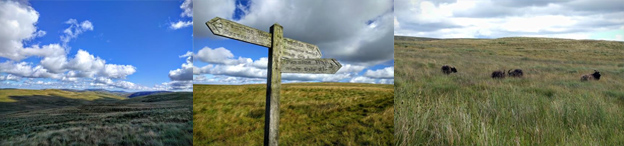
After about 8 miles we reached a refuge hut just before Lambs Hill where we stopped for lunch. There were a couple of other independent walkers there, I think they thought they'd have a peaceful day out until us lot all arrived!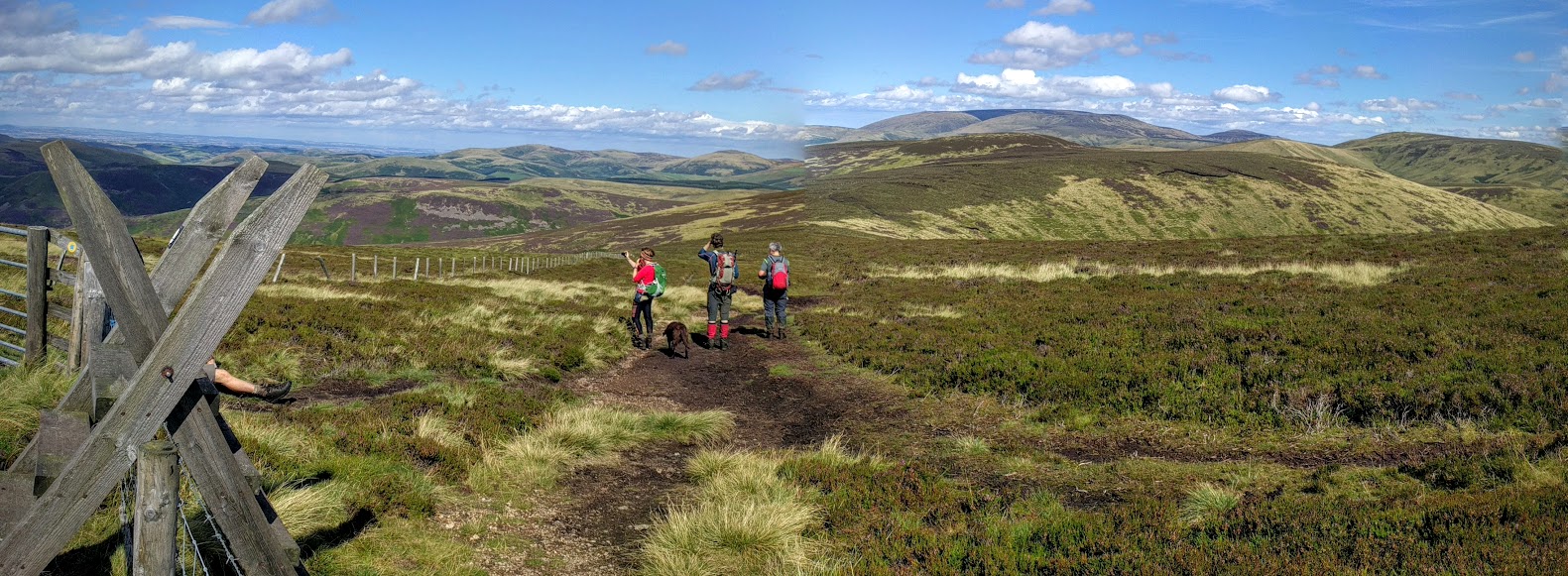
From the refuge hut, the trail continued ascending and descending following the border fence line, and the views were getting better and better with The Cheviot also coming into view where we'd be walking the following, final day. We eventually reached Russell's Cairn on Windy Gyle, the approx. half way point through the Cheviots and the turn-off point for our pick up. The cairn was a huge pile of rocks with a low level circular shelter where we all sat for a break admiring the views. We'd arrived early at 3pm, our pick-up had been arranged for 5pm, but one group member managed to phone the B&B and rearrange for a 4pm pick up luckily.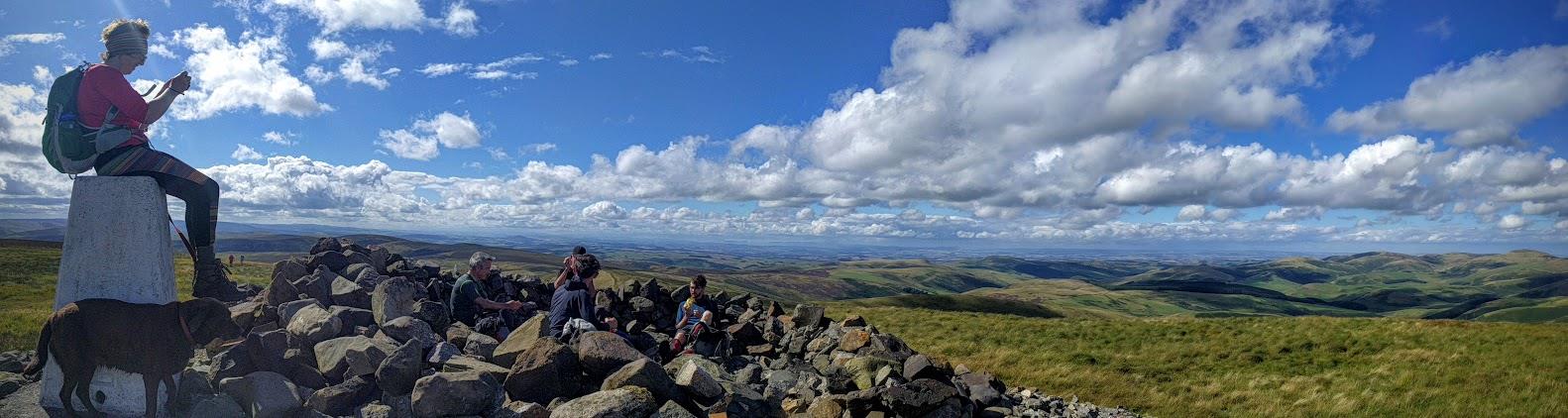
It was extremely windy heading up to Windy Gyle, an aptly named summit. Here I said goodbye to four friends who I'd been walking with regularly over the last week or so; they were continuing on and wild camping the last night so I wouldn't see them again. From Russell's Cairn our B&B group still had a two mile detour south from the trail, all downhill to reach Trow's Farm, the nearest drivable track to the Pennine Way and our now 4pm pickup point back to Byrness for the night again.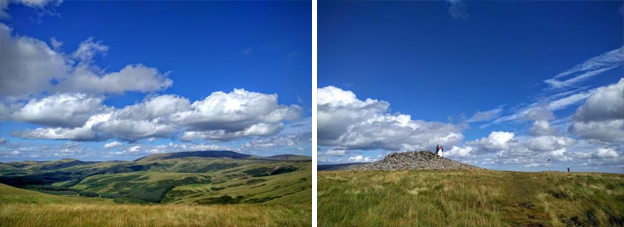
Another beautiful, clear, sunny day for my final day, and the wind had died down too. The same group as yesterday were dropped back off at Trows Farm to retrace our steps 2 miles back uphill to rejoin the Pennine Way at Russell's Cairn/Windy Gyle.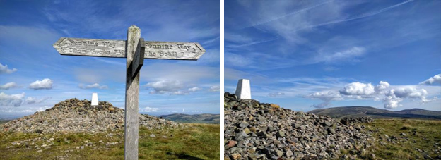
The trail from Windy Gyle followed the English side of the English/Scottish border fence line for most of the day. There were fantastic views again of the Cheviot and all around. Our group split today as there were no group pickup times to stick too anymore, so 3 of us headed off at a faster pace leaving the others coming slowly behind. I had a 5pm taxi pick up in Kirk Yetholm to meet and the two other guys wanted to take the optional side route to the summit of The Cheviot (which is at least another hour there and back). The walk to meet the side route up to The Cheviot was easy going up and over King's Seat, as it was slabs most of the way. From the junction it was a change of direction heading to Auchope Cairn, on top of a large rocky outcrop. It was a long steep descent, the steepest on the entire Pennine Way probably, down to another refuge hut where I took a short break, looking back towards Auchope Cairn in the distance.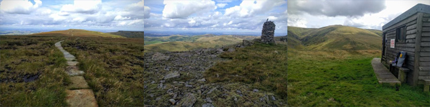
From the refuge hut the trail continued round, passing some cows before reaching the base of The Schill, the final climb of the trail. First though I had to do a balancing act, shuffling along a few fence bars to avoid an extremely boggy area just before the short steep climb up to The Schill.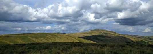
Just down the other side of The Schill a sign told me I had 4.5 miles to go to reach Kirk Yetholm and the end of my Pennine way journey. Another half a mile further and the trail split into two, with a high level route or a low level route option. Because I didn't want to risk missing my booked taxi I took the low level route option, half an hour quicker than the high route. The trail continued downhill on good grassy paths until it met a farm track by Walterburnhead Farm. From here it was track and road walking all the way to Kirk Yetholm and The Border Hotel, and the end of the Pennine Way.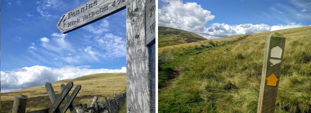
The hotel has a register for all Pennine Way completers to sign and they then issue you with a certificate and free half pint of beer! I don't drink beer but was unable to choose an alternative celebratory drink, as the free beer is sponsored and paid for by the brewery.
I had arrived early, with an hour to spare, so I got changed and ordered a meal, plus of course had my photo taken beside the 'End of the Pennine Way sign.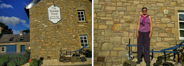
Contours Holidays pride ourselves on our expert knowledge of the UK’s trails. We regularly set out to check our routes and directions and to make improvements on the holidays we offer. You can find several write-ups of staff expeditions in our Trail Diaries.