Isle of Anglesey Coast Path

Isle of Anglesey Coast Path

A walk through a landscape of farmland, dunes and cliffs on the Isle of Anglesey, off the mainland of Wales.

4 to 16 nights
28-140 miles
Easy / Moderate to Demanding

From £495 per person

Find your holiday

About the trail

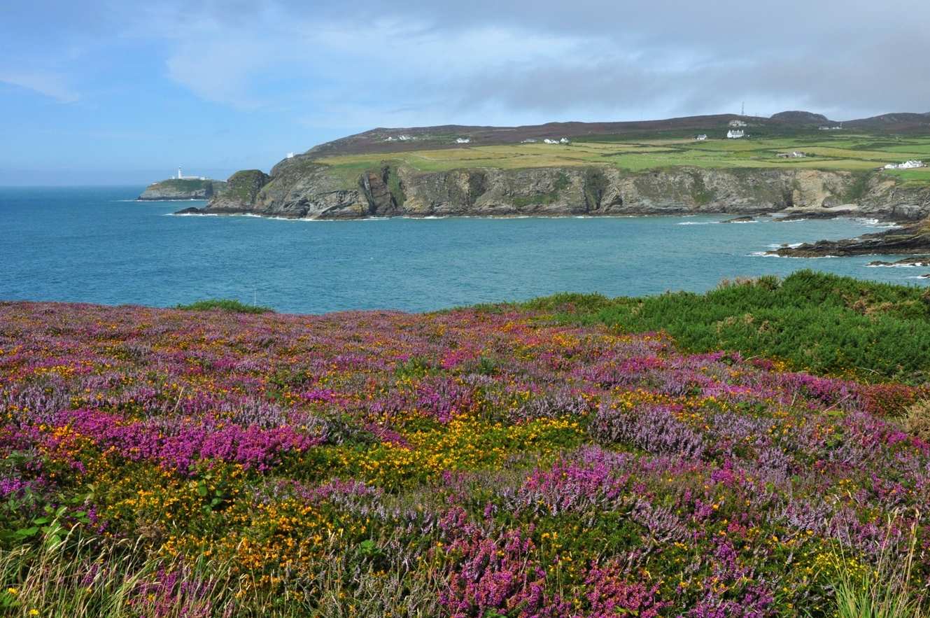
Anglesey (Ynys Môn) lies off the coast of North Wales, separated from the mainland by the Menai Strait. The Isle of Anglesey Coast Path encircles this enchanting island, taking in sandy beaches, expansive dunes, rocky headlands and towering sea cliffs. The trail visits quaint fishing villages and bustling seaports, as well as numerous reminders of Anglesey's colourful history.

From spring to autumn the island is carpeted with flowers, while the cliffs, offshore islands and surrounding waters are home to a range of wildlife. The island's close proximity to the mainland means the mountains of Snowdonia and the hills of the Llyn Peninsula provide dramatic backdrops along this stretch of the Wales Coast Path.

We offer multiple holiday options along this trail. If you wish to experience the entire trail, simply select the first option from the list below.

Choose your route

  • Isle of Anglesey Coast Path
  • Isle of Anglesey Coast Path - North Section
  • Isle of Anglesey Coast Path - South Section
  • Isle of Anglesey Coast Path Short Break

About this route

5 to 8 nights
67 miles
Moderate to Demanding
1st March to 15th October

From £640 per person

Isle of Anglesey Coast Path - South Section

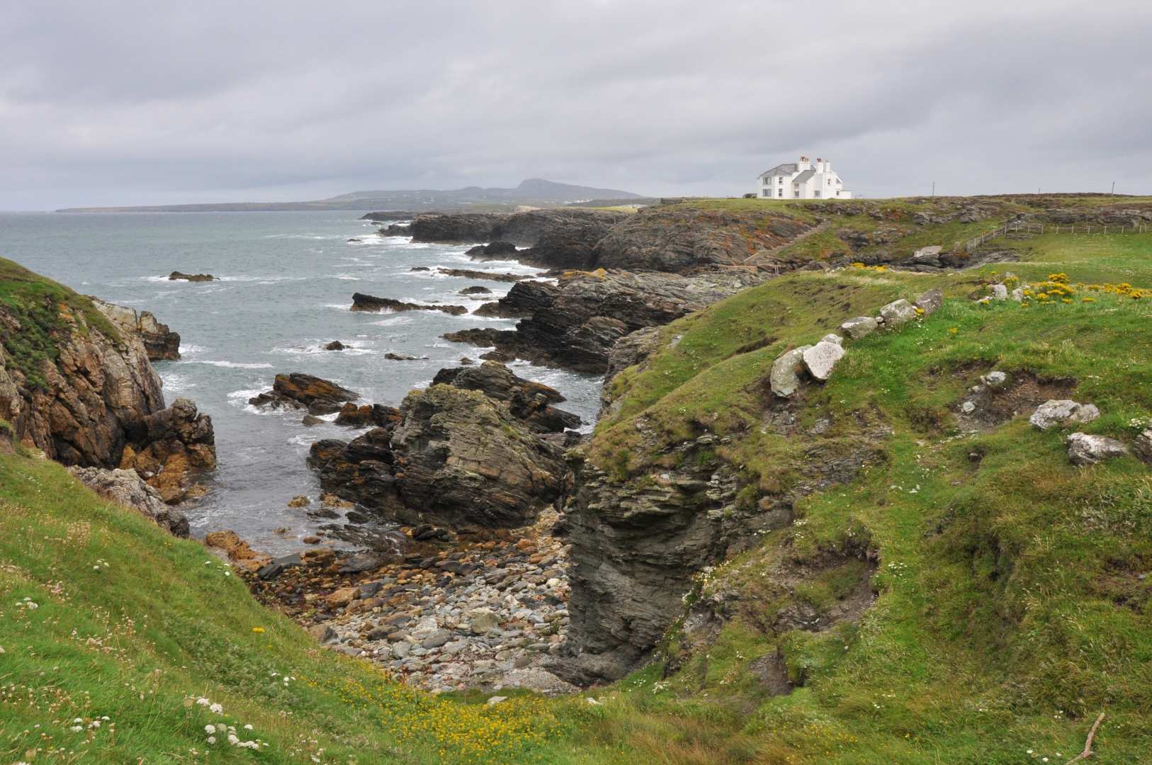
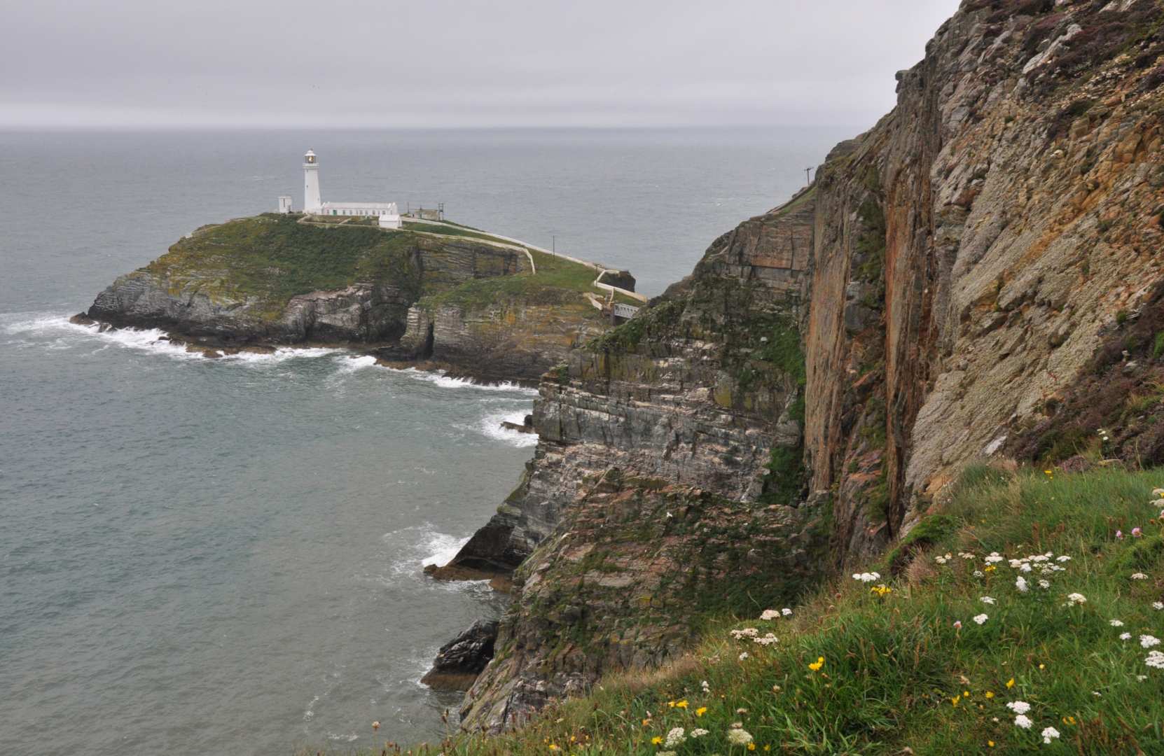
The south section of the Isle of Anglesey Coast Path starts at the busy ferry port of Holyhead and negotiates rocky headlands and sandy coves on the way to Bangor.

Incredible, far-reaching views can be gained from atop Holyhead Mountain, the highest point on the island, while the lower lying terrain boasts tranquil forests, golden beaches and thriving ports and fishing villages.

Sites of particular interest include the amazing rock arches of Bwa Du and Bwa Gwyn, the beautiful South Stack Lighthouse and the 12th century church of St Cadwaladr containing the Cadfan Stone.

Available tours

Code Tour Duration Difficulty Price per person
IACS1 From Holyhead to Bangor 5 nights, 4 days walking Demanding £640
IACS2 From Holyhead to Bangor 6 nights, 5 days walking Moderate / Demanding £765
IACS3 From Holyhead to Bangor 8 nights, 7 days walking Moderate £1015

Short breaks

Code Tour Duration Difficulty Price per person
IACSB From Holyhead to Rhosneigr(L) 4 nights, 3 days walking Easy / Moderate £495

Isle of Anglesey Coast Path - South Section 5 nights, 4 days walking

£NNN per person
  • Itinerary
  • What's included?
  • Extra nights?
  • Tour facts
  • Route profile
  • Travel info
  • Weather
  • Holiday Highlights

Important information

Please note that due to accommodation costs for Rhosneigr and Aberffraw(T) (which requires a transfer back to Rhosneigr) being very expensive, especially in high season, an upgrade supplement may apply for these locations. If an upgrade supplement is necessary, we will inform you accordingly before accepting your booking.


Start

Travel to Holyhead where your first night's accommodation will be booked

Day 1

Holyhead to Trearddur. 12.5 miles (20km)

Day 2

Trearddur to Rhosneigr(L). 16 miles (25.5km)

Day 3

Rhosneigr(L) to Dwyran(L). 21 miles (33.5km)

Day 4

Dwyran(L) to Bangor. 17.5 miles (28km)

Finish

Depart from Bangor after breakfast

Your Itinerary

This itinerary lists our preferred overnight stops for this tour. Sometimes there may be a shortage of available accommodation in a preferred location, in which case we will transfer you from the trail to your accommodation and back again at no extra charge. Overnight stops marked with a (T) will always require transfers as standard.

Overnight stops marked with an (L) have very limited accommodation, and therefore more often than not will also require a transfer, particularly on bank holidays and weekends. We will use non-transfer accommodation wherever possible.

The daily mileages quoted are average trail miles only and do not include the distance from the trail to your accommodation. We do not expect you to have to travel more than a mile from the trail to your accommodation in most cases; should your accommodation be further than this, transfers will be provided as standard if practical. A very limited number of stops will require you to travel on foot up to two miles off the trail, however these instances will be clearly communicated to you if applicable.

Further transfers may also be required due to some accommodations having a two-night minimum booking policy, especially at weekends.

Below are the additional costs that may apply depending on your requirements. Dog-friendly tours are subject to a Daily Dog Charge, which will be listed below if applicable. Our standard prices per person are based upon two people sharing a room; if you are on your own, or are part of a group but require a room of your own, then the Solo Traveller or Single Supplements apply respectively:

A note about transfers
Solo Traveller Supplement
£70.00 per person / per night
Single Supplement
£55.00 per person / per night


You can add rest days at any of the overnight stops:

Extra night (Standard)
£65.00 per person / per night
Extra night (Rhosneigr(L))
Price on request
Standard
Interactive
© Contours Walking Holidays Isle of Anglesey Coast Path - South Section map
Holyhead to Bangor
67 miles (107 km)
1st March to 15th October

Holiday highlights

Admiring the spectacular coastal scenery of Anglesey and across the Menai Strait to the mountains of the Snowdonia National Park.

Enjoying one of the very best beaches in Anglesey beyond Cable Bay, where sloping dunes give way to smooth, golden sand.

Spotting the many species of birdlife in the coastal dunes, including Razorbills, Choughs, Guillemots and Terns.

What's included?

  • 5 nights' accommodation in en-suite rooms (where available) in selected B&B’s, hotels, inns and guesthouses along the trail, or a short distance away via taxi provided at our expense.
  • Breakfast each day.
  • Door to door luggage transfer.
  • Maps with the route marked on and a guidebook or route notes describing the trail.
  • An information pack containing an itinerary, instructions on how to find your accommodation each night and a kit list.
  • Detailed travel instructions on how to get to the start of your holiday and back from the end of it.

Extra Nights & Rest Days


You can add rest days at any of the overnight stops:

Extra night (Standard)
£65.00 per person / per night
Extra night (Rhosneigr(L))
Price on request

Tour Facts

Total distance: 67 miles (107 km)
Duration: 5 nights, 4 days walking
Minimum daily distance: 12.5 miles (20 km)
Maximum daily distance: 21 miles (33.5 km)
Code: IACS1 Grade: Demanding
Season: 1st March - 15th October
Start of holiday: Holyhead
End of holiday: Bangor

Route Profile

Isle of Anglesey Coast Path - South Section Route Profile

Travel Information

Useful information and travel links that will assist you in your plans to travel to the start of the holiday and back from the end of it are sent to you with your full tour pack. A summary is given below:

By Air - The most convenient major city and international airports are Manchester, Liverpool John Lennon and Cardiff.

By Rail - There is a rail station at the start of the trail (Holyhead) and also at the end of the trail (Bangor).

By Bus - Various bus services run to Holyhead and from Bangor.

From London - Trains run from London Euston station to Holyhead.

Return To The Start - The easiest way to return to the start of the trail, is to take a train from Bangor to Holyhead.

Weather Information

To find out more about the weather forecast for your chosen holiday's general location, please see the following websites:

  • MetCheck - This website allows you to look up detailed weather information for specific locations as far as six months in advance.
  • Met Office - This website shows regional area forecasts a few days in advance, with a general UK forecast description of up to 30 days in advance.
  • Mountain Forecast - This website shows what the forecast is like up on specific hills and fells, and offers forecasts a few days in advance.