Three Dales Way: A Taste of Yorkshire's Finest
See the best of Yorkshire on the Three Dales Way, a short walking holiday for solo walkers or groups.
Three Dales Way: A Taste of Yorkshire's Finest
https://www.contours.co.uk/three-dales-way-blog
by Richard Jones
The Yorkshire Dales evokes images of green fells rising high among the network of dales, hillsides a lattice of dry-stone walls. Rushing waterfalls provide a backing soundtrack to the bleating voices of sheep, while the distinctive limestone pavements of the Pennines lie scattered across the ground.
For many people the landscape of the Lake District draws them to the north of England, but for me it is the wide-open skies and quieter beauty of the Dales. God’s Own Country, they call it, and I can see why.
So, when an opportunity arises to tackle the Three Dales Way, I’m more than happy to take myself up there for a few days’ walking in this glorious landscape. What better way to spend some time than on a walking holiday in Yorkshire.
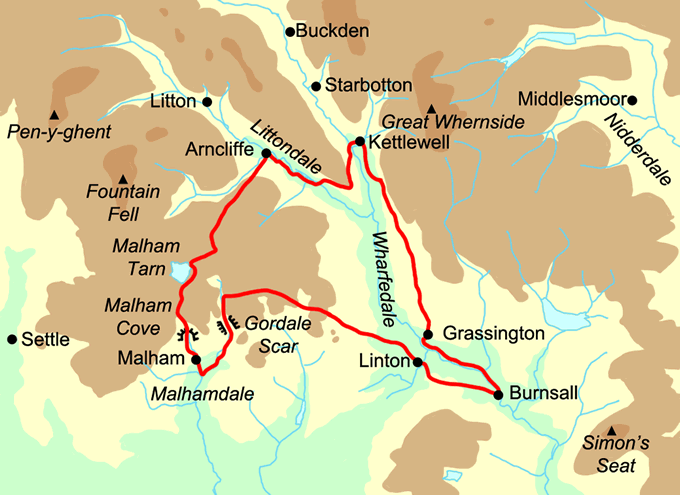
I easily persuade a Yorkshire (well, Doncaster) friend to join me, and we meet up by the Red Lion Hotel in Burnsall, ready for the first leg along the Dales Way to Kettlewell.
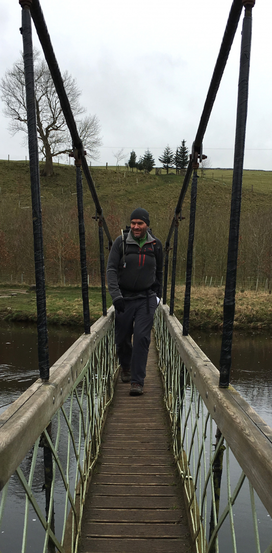 It’s a gentle introduction, following the course of the River Wharfe for the first three miles up to Grassington. The Dales Way crosses the river by means of a particularly springy suspension bridge (there were also stepping stones, somewhat submerged on this March day!) before taking in the thunderous waters at Linton Falls and reaching the lovely village of Grassington.
Grassington is a real Dales honeypot with its shops, cafés and pubs. It’s tempting to stop a while, but we continue up the main street and rejoin the route north of the village, where it skirts the Dales Dairy and climbs across fields and limestone.
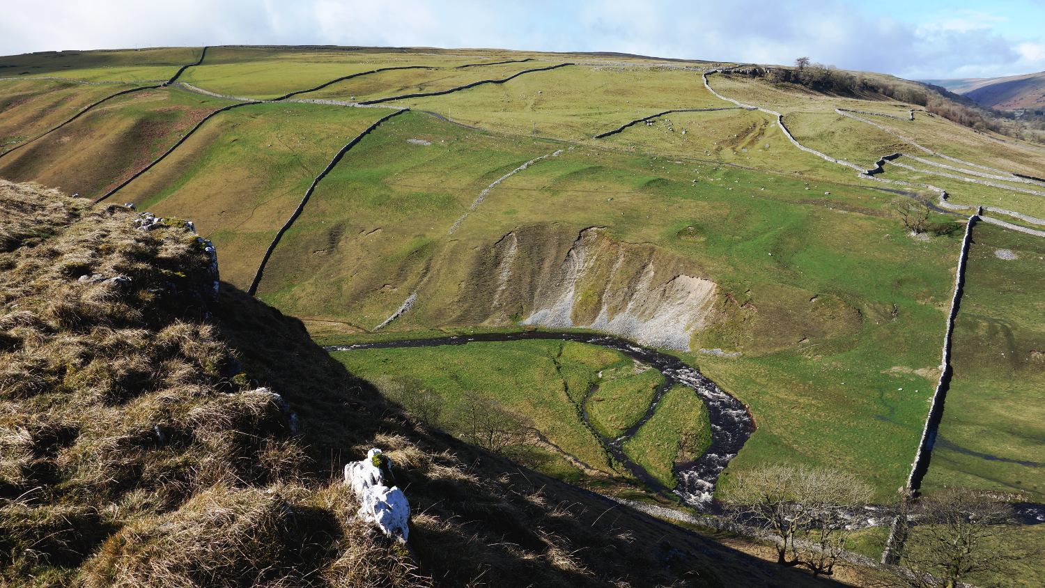
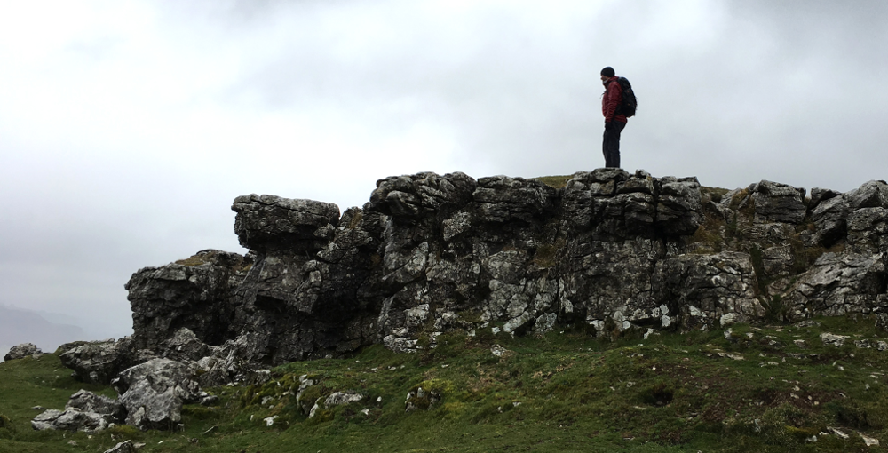
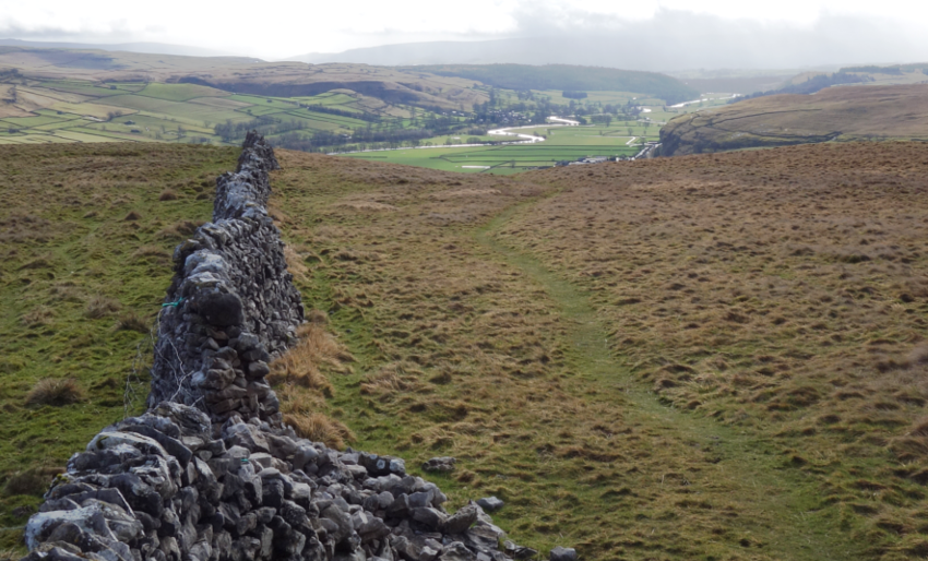
We soon reach the deep scar of Conistone Dib and, tempting as it is to clamber down this spectacular chasm, we continue a little further on to reach Conistone Pie, a limestone outcrop that’s unsurprisingly shaped like a pie. It gives splendid views of today’s route through Wharfedale and tomorrow’s along Littondale.
We meet a track at the edge of woodland and descend sharply, almost to the river again, before crossing meadows separated into narrow fields by ribbons of dry-stone wall and easing ourselves through the squeeze styles at each one. Soon we reach Kettlewell, where the café serves up sizeable chunks of hot fudge cake and tea, before settling into the Blue Bell Inn for the evening. Tales from an 80-year-old fell runner keep us well entertained until late on into the evening.
The next morning, following a hearty breakfast, we head out on the next leg towards Malham. We cross the River Wharfe once again before taking the permissive footpath away from the road, climbing sharply through moss-laden walls towards the scar above.
At the top, the shoulder of the hill provides a wonderful aspect looking west towards Hawkswick and into Littondale, and down onto Kilnsey Crag to the south. It’s made even better as the sun emerges and clouds separate to reveal a sky of blue.
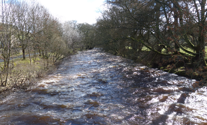
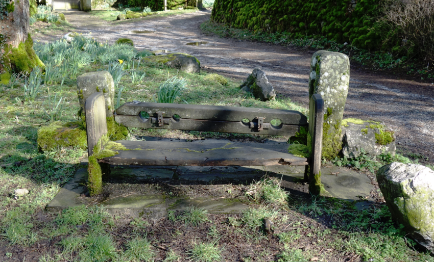
We descend into Hawkswick, alongside the tumbling waters of the River Skirfare, which we soon cross and then follow into Arncliffe, a village still sporting stocks to warn off any ne’er-do-wells. I don’t hang around!
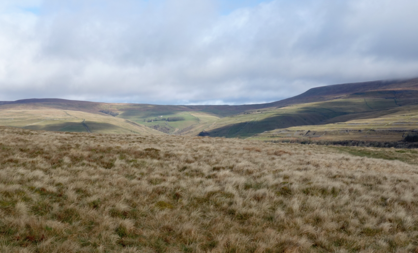
Resisting the temptation to call into The Falcon, we follow the track to its side and climb to the rocky edge of Yew Cogar Scar by the Monk’s Road, a centuries-old monastic route up over the limestone moors. The route stretches ahead as a strip of green, requiring no real navigation as it pulls you along through this spectacular landscape.
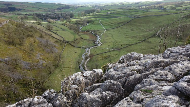
.png) One of the treasures of the Yorkshire Dales is that feeling of being on top of the world, and you certainly get that impression when you look down to Cowside Beck below — stunning!
One of the treasures of the Yorkshire Dales is that feeling of being on top of the world, and you certainly get that impression when you look down to Cowside Beck below — stunning!
Ahead a distinctive, flat-topped hill comes into view: Back Pasture. Below it we pass Middle House, thought to have originally been the site of a Norse settlement before it was taken over by the monks of Fountains Abbey. The derelict farmhouse standing here dates from the 17th century and has been partly restored by the National Trust in the years since 1990, its moss-covered walls giving the impression that is has remained untouched for many years.
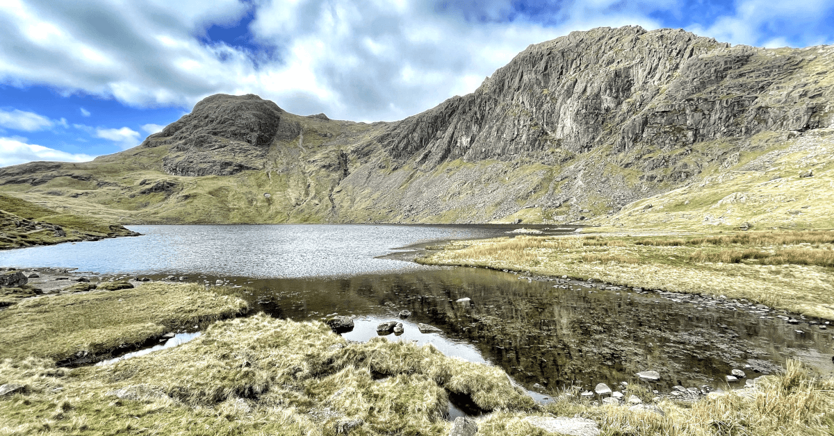
The map shows Malham Tarn lying ahead, hidden until we reach the saddle between two hills. It spreads out in front of us, sun glistening on its surface.
.png)
Up close the water is surprisingly choppy, a reflection of the breeze blowing across the water. Our route traverses around the east side of the tarn, the cliffs of Great Close Scar standing high to our left.
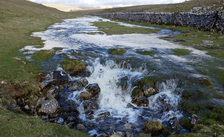 Here the route joins the Pennine Way where, on the other side of a car park, we follow a stream that suddenly disappears into the ground at the appropriately named Water Sinks.
For many years it was thought that this water fell into the deep limestone fissures underground, later to emerge at the foot of Malham Cove as Malham Beck. However, dye testing has disproved this theory. The water here actually reappears south of Malham Village, at Aire Head Springs, the source of the River Aire.
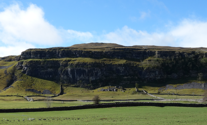
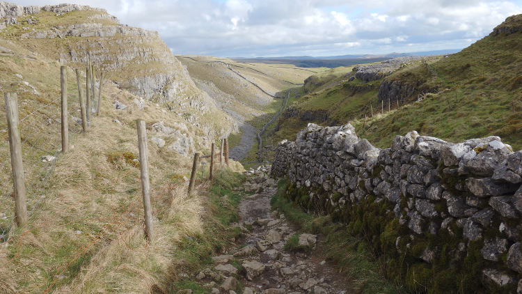
.png) The walking ahead can only be described as spectacular, following the dry valley to descend beneath Ing Scar and cross the limestone pavements of Malham Cove.
The walking ahead can only be described as spectacular, following the dry valley to descend beneath Ing Scar and cross the limestone pavements of Malham Cove.
The peace of the walk is broken only by the number of visitors to this impressive site, but that’s hardly surprising as it is a stunning location.
We soon descend steeply down to the base of the cove, where you cannot help but gaze back up at the huge, natural limestone amphitheatre above.
Then we head into the village itself, where we enjoy an excellent meal at Beck Hall and just a few well-earned drinks in the local pub.
Our third day soon sees us depart from the Pennine Way as we head northeast towards Janet’s Foss, a small waterfall that surges into the pool below. Janet was supposedly the Queen of the Fairies, who lived in a cave behind the falls!
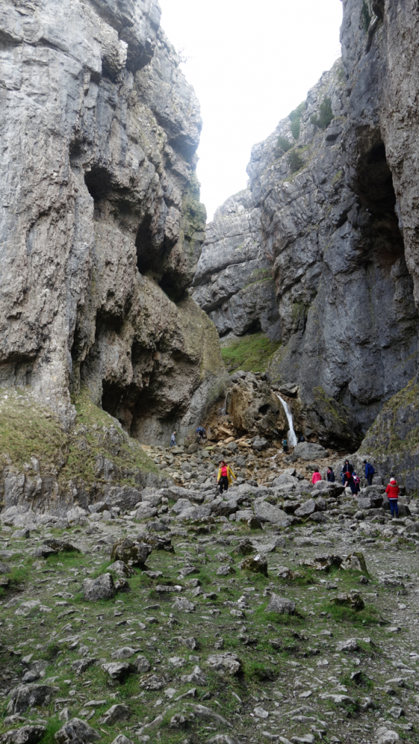
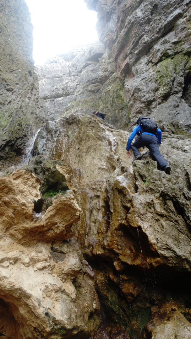
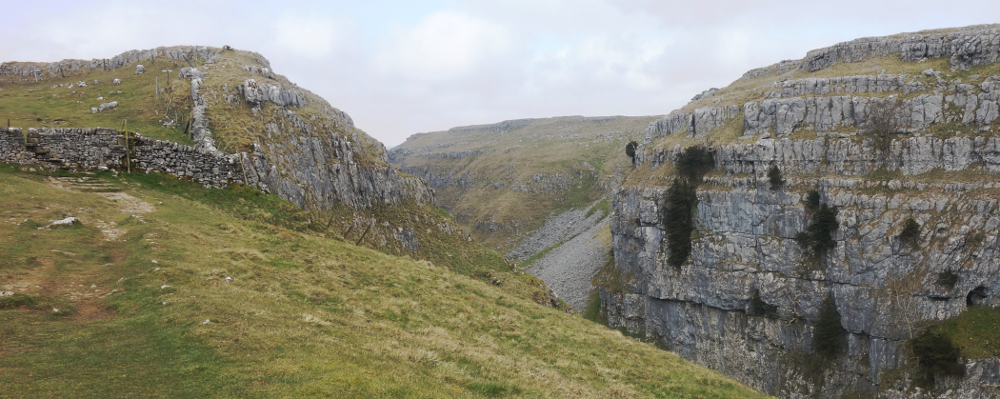
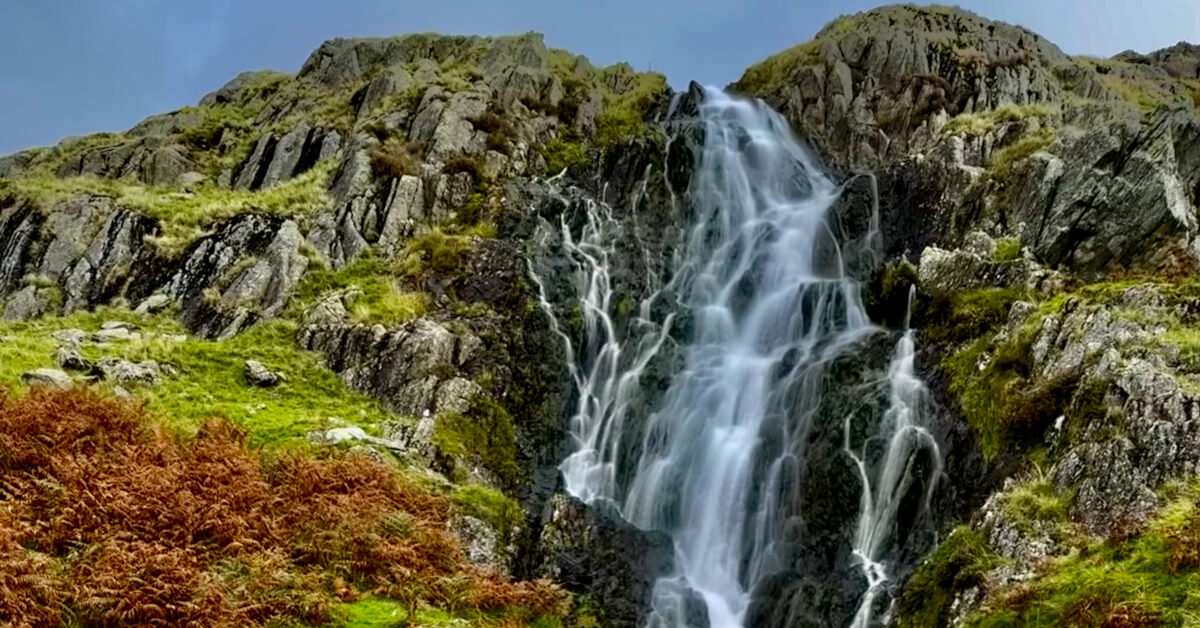
Beyond here, we cross the road and into a huge gorge that leads us towards Gordale Scar, spectacularly cut into the Limestone Hills by glacial waters during the Ice Ages, complete with waterfalls cascading down.
The path heads up through the gorge. There’s a less-demanding option taking you back to the road and up to Mastiles Lane that way, but today it is dry and we eagerly clamber up the rocks. It does look daunting from below, but the rocks offer numerous handholds and it is a fairly straightforward, if energetic, climb up.
At the top, we cross the moor, again dotted with limestone pavements, to reach the beginning of Mastiles Lane, an old drovers’ road that has been in use since before Roman times. The site of a Roman marching camp is still visible on the trail.
Near the end of the walled track, we turn right to head towards Bordley, where all manner of animals compete to make the most noise at the farm. A short climb out the other side leads to a long and steady descent into the hamlet of Skirethorns, where we navigate our way across several fields to arrive just south of Threshfield. We cross the road and over a bridge that once spanned the long-gone railway line before reaching the attractive village of Linton, with its two stone bridges crossing Linton Beck, overlooked by the impressive Fountaine Hospital.
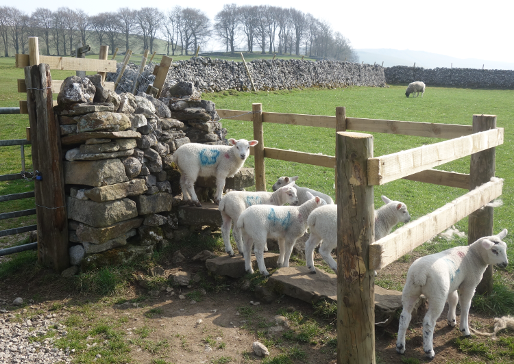 We continue on our way, crossing fields while watched by curious lambs, even finding several climbing on a wall stile as if queuing to cross it!
We pass through Thorpe, pausing briefly at the green to read about the maypole the villagers once stole from Burnsall, before soon entering a delightful walled track and then descending across multiple fields and through dry-stone walls to reach our destination of Burnsall itself, where tea and cake await.
Our Three Dales are done. In a relatively short space of time, we really do feel that we’ve experienced some of the best the Yorkshire Dales has to offer, from the tranquillity of the Dales Way alongside the Wharfe, to the dramatic scenery along the Pennine Way above Malham and the challenge and reward of ascending Gordale Scar. It may be a snapshot of the area, but the Three Dales Way feels much more like a panoramic view: well worth immersing yourself into.
Book a walk along the Three Dales Way.
Contours Holidays pride ourselves on our expert knowledge of the UK’s trails. We regularly set out to check our routes and directions and to make improvements on the holidays we offer. You can find several write-ups of staff expeditions in our Trail Diaries.
.png)
Visit many of the charming villages of the Dales, including Burnsall, Grassington and Malham.
Marvel at the natural wonders of Malham Tarn, England’s highest lake; Malham Cove; and Gordale Scar, a gigantic collapsed cave system.
Wander through Littondale to the rushing waters of the River Skirfare.
| Code | Tour | Duration | Price per person | |
|---|---|---|---|---|
| 3DW | A circular trail beginning at Burnsall(L) | 3 days walking | £554 |


