Walking the Mary Queen of Scots Way
Our experiences on the Mary Queen of Scots Way, a scenic walking holiday across Scotland.
Walking the Mary Queen of Scots Way
https://www.contours.co.uk/walking-the-mary-queen-of-scots-way
By Christine Saul
During July, when the UK was blessed with hot, sunny weather (even in Scotland!) I set off to walk the Mary Queen of Scots Way from Inversnaid to Falkland. The entire trail crosses Scotland from west to east, passing places once frequented by Mary Queen of Scots; beginning at Inversnaid on the shores of Loch Lomond, and ending in St Andrews. The trail offers lots of variety in both scenery and terrain, with urban, rural and remote walking across the lowlands of Scotland through the Trossachs, Ochils and Lomond Hills. Some sections are easy walking, while other sections are demanding; the trail has a great mix of forest tracks, cycle ways, woodland, riverside and farmland paths, as well as crossing some pathless moorland sections. It goes through mountains and beautiful glens, and passes lochs, gorges, rivers and waterfalls, as well as castles, hill forts and aqueducts. I saw plenty of wildlife, including deer and birds of prey. Some days I didn't see anyone else all day. The trail surprised me with how beautiful it was in places. The only thing that disappointed me whilst walking this trail, was not seeing a red squirrel!
My first day of walking the Mary Queen of Scots Way involved a ferry ride from Tarbet to Inversnaid across Loch Lomond. I'd travelled up by train to Arrochar and Tarbet station the previous day, a long full day’s journey and spent the night in Tarbet ready to catch the first ferry of the day to Inversnaid at 10am. Tarbet was a beautiful setting on the shores of Loch Lomond and in the warmth of the evening sun people were having BBQ's, jumping off the pier and swimming in the loch.
NB: The ferry ride is no longer necessary on Contours Mary Queen of Scots Way itinerary, we transfer you from Aberfoyle to Inversnaid instead meaning you can get an earlier walk start; the ferry crossing is still necessary however on our Greater Scottish and Scottish Coast to Coast Walks.
The ferry was delayed 20 minutes awaiting the arrival of a young stewardess. Once she arrived though we were off on the scenic 30 minute ride up Loch Lomond to Inversnaid. It was a glorious sunny day so everyone sat on the open top deck of the ferry. I dropped off my luggage with the taxi driver who was waiting for me at Inversnaid and set off briskly at 11am on my walk; the first day of the trail is a long 17 mile day, which cannot be shortened due to the remoteness of this section, therefore I had a lot of ground to cover following a late start. For the first couple of miles the trail heads south along the West Highland Way through the forested shores of Loch Lomond.
.jpg) From Cailness, where there was a new rustic café, the trail left the West Highland Way and climbed steeply following a track zig-zaging up out of the valley. It was a sweltering climb in the heat with next to no breeze, however there were great views over the loch and towards the highlands.
From Cailness, where there was a new rustic café, the trail left the West Highland Way and climbed steeply following a track zig-zaging up out of the valley. It was a sweltering climb in the heat with next to no breeze, however there were great views over the loch and towards the highlands.
.jpg) Eventually the top was reached and I was rewarded with fantastic views of Ben Lomond. The track now entered Gleann Gaoithe – pronounced glen gooee, meaning the windy glen. It was not particularly windy but thankfully I was now walking into a cooling easterly breeze. The glen stretched in front of me for miles with views of the winding track I was to follow gradually downhill ahead. It was a beautiful remote glen constantly in the shadow of Ben Lomond to my right and eventually behind me.
Eventually the top was reached and I was rewarded with fantastic views of Ben Lomond. The track now entered Gleann Gaoithe – pronounced glen gooee, meaning the windy glen. It was not particularly windy but thankfully I was now walking into a cooling easterly breeze. The glen stretched in front of me for miles with views of the winding track I was to follow gradually downhill ahead. It was a beautiful remote glen constantly in the shadow of Ben Lomond to my right and eventually behind me.
The track passed a couple of remote farms before reaching old felled forest areas which are now regenerating with young trees. Not tall enough to provide any shade sadly. The trail followed close by to Duchray Water in the valley passing a small loch, Loch Dubh, it turned a corner and I was greeted with an impressive Victorian aqueduct. Shortly after I reached a second aqueduct, valve house and walled causeway.
.jpg) The last few miles continued along forest tracks. I saw 3 buzzards flying above me, it looked like they were fighting over something mid flight; they flew off when they saw me. The track continued past Duchray Castle and a few other remote properties down towards Aberfoyle. I’d not seen anyone else all day since leaving the West Highland Way, however a few cars passed me on the final leg of the forest track, kicking up an unpleasant dust cloud as they past due to the dry weather. An Asda online delivery guy also drove past me and stopped to proudly tell me “you won’t find Tesco coming out here!”
The last few miles continued along forest tracks. I saw 3 buzzards flying above me, it looked like they were fighting over something mid flight; they flew off when they saw me. The track continued past Duchray Castle and a few other remote properties down towards Aberfoyle. I’d not seen anyone else all day since leaving the West Highland Way, however a few cars passed me on the final leg of the forest track, kicking up an unpleasant dust cloud as they past due to the dry weather. An Asda online delivery guy also drove past me and stopped to proudly tell me “you won’t find Tesco coming out here!”
The last stage passed another loch, Lochan Spling, before heading down to Aberfoyle, a picturesque village which lies at the southern gateway to the Trossachs at the join between the Scottish Highlands and the Lowlands. It was a tiring and hot but very enjoyable first day!
This section of trail predominantly follows the route of the Rob Roy Way. The trail left Aberfoyle rising steadily on a forest track past an outdoor centre where I saw an impressive large woodpecker. The track continued steadily uphill to arrive above Aberfoyle golf course. There were great open views out over the golf course before the trail re entered the forest. It was another hot day so I was grateful for some shade under the trees. The trail left the Rob Roy Way for a while, instead climbing an alternative forest track up to a viewpoint looking down over the Lake of Menteith (or Loch Inchmahome) where Mary Queen of Scots was a frequent visitor to Inchmahome Priory, on the Lake of Menteith, as a child. The trail then descended steeply to rejoin the Rob Roy Way through a bit more forest before reaching an open moorland section.
Back into forest the trail climbed gently to reach a man made fishing loch, Lochan Allt a’Chip Dhuibh. It reminded me of the ponds you find in the forests of Maine in North America, I half expected to see moose feeding in the water or a beaver dam! It was very pretty and covered with lots of yellow water lilies, with a small boat house and a few rowing boats.
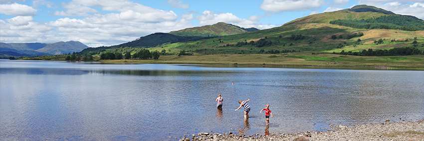
.jpg) Shortly after, felled forest meant there were clear views down over the larger Loch Venachar. The forest track continued downhill eventually reaching the loch side and followed a lane alongside the loch. Beautiful wooded loch side camping spots with fire pits were scattered alongside the loch; permits were required to camp there. At the end of the loch there was a beach area with picnic tables which all had metal bbq hot plates for placing disposable bbq’s on – amazing, I’ve never seen this in England, unless I'm just going to the wrong places!) There were a handful of people and kids sunbathing and impromptu swimming in the loch. It was beautiful, with fantastic views right down the length of the loch, so I stopped for a lunch break, took my boots off and had a refreshing paddle; the loch water was surprisingly warm.
Shortly after, felled forest meant there were clear views down over the larger Loch Venachar. The forest track continued downhill eventually reaching the loch side and followed a lane alongside the loch. Beautiful wooded loch side camping spots with fire pits were scattered alongside the loch; permits were required to camp there. At the end of the loch there was a beach area with picnic tables which all had metal bbq hot plates for placing disposable bbq’s on – amazing, I’ve never seen this in England, unless I'm just going to the wrong places!) There were a handful of people and kids sunbathing and impromptu swimming in the loch. It was beautiful, with fantastic views right down the length of the loch, so I stopped for a lunch break, took my boots off and had a refreshing paddle; the loch water was surprisingly warm.
 Shortly after the loch the trail entered Coilhallan Wood, climbing steadily up another forest track. A roe deer came running through the trees directly towards me, it was only about 5 metres away when it spotted me and ran off in the opposite direction. At the end of the wood a path descended down towards Callander, eventually crossing the River Teith into Callander High Street. Callander is a bustling small tourist town, often referred to as the ‘Gateway to the Highlands’, with lots of pretty gift shops and plenty of eateries. It can get especially busy at weekends apparently, luckily I was there midweek.
Scotland is renowned for its midges. I had no problems with them however, it was the cleggs (female Scottish horse flies) that were occasionally bothersome – especially in the forested areas when I stopped, they gave me a few nips but luckily with no adverse reaction. BBC News had reported a rise in horsefly bites due to the prolonged hot weather.
Today was a complete contrast to the last couple of days, leaving the Trossachs behind the trail now crossed lower level farmland and riversides and the trail was almost nearly all flat. It was another hot sunny day again. The trail left Callander on a cycle way which followed an old dismantled railway line for about 2.5 miles, paved for the first half then a gravel track. Eventually the trail climbed gradually up into a forest plantation through old and newly regenerating forest. Leaving the forest, the trail followed a raised bank which would normally be enclosed each side by peat bog, although it had just about dried out in the current heat wave. Entering open countryside, to my right was a vast expanse of beautiful cotton grass fields glistening in the sunlight, with orchids also growing amongst the grass, it was mesmerizing. I also disturbed another deer, sheltering in bushes in the shade.
.jpg) Leaving the cotton grass fields behind, the trail followed quiet lanes for a while through farmland. Sheep were huddled together lying and sheltering in the shade under a tree and there were lots of pretty wild flowers in the hedgerows.
Leaving the cotton grass fields behind, the trail followed quiet lanes for a while through farmland. Sheep were huddled together lying and sheltering in the shade under a tree and there were lots of pretty wild flowers in the hedgerows.
.jpg) Eventually the trail re-entered woodland, traditional woodland rather than managed pine forestry woods, following alongside a burn and passing Old Kilmadock Cemetery before reaching the River Teith. Here were a couple of large old logs perfect for sitting on for lunch right next to the river and a little stone fishermans hut; the river was beautiful glistening in the sunlight.
Eventually the trail re-entered woodland, traditional woodland rather than managed pine forestry woods, following alongside a burn and passing Old Kilmadock Cemetery before reaching the River Teith. Here were a couple of large old logs perfect for sitting on for lunch right next to the river and a little stone fishermans hut; the river was beautiful glistening in the sunlight.
The trail continued alongside the river, where there were more pretty wild flowers and a large heron which took flight once it spotted me, then headed inland back into forest. Pine forest again but this time the tracks were soft and laden with pine needles, it was like walking on carpet and a pleasant brief relief for tired hot feet rather than walking on the harder gravel forest tracks.
.jpg) The forest track emerged just outside of Doune where the trail passed by the beautifully preserved medieval Doune Castle; not only famous for its connections with Mary Queen of Scots but also Monty Python, the film Monty Python and the Holy Grail was filmed there. I didn’t go in but for a reasonable entrance fee you can visit inside the castle. From the castle it was a short walk into the centre of Doune village with its pretty cottages and small shops. In the village centre, Dounes Mercat Cross stands where, historically, village fairs and even hangings also took place.
The forest track emerged just outside of Doune where the trail passed by the beautifully preserved medieval Doune Castle; not only famous for its connections with Mary Queen of Scots but also Monty Python, the film Monty Python and the Holy Grail was filmed there. I didn’t go in but for a reasonable entrance fee you can visit inside the castle. From the castle it was a short walk into the centre of Doune village with its pretty cottages and small shops. In the village centre, Dounes Mercat Cross stands where, historically, village fairs and even hangings also took place.
Leaving Doune it was back to walking on paved cycle ways again heading for Dunblane, a couple of miles away. The last section followed the Old Doune Road, a single track road which was formerly the main route between Doune and Dunblane. The Mary Queen of Scots way does not actually go into Dunblane but skirts around its edge.
Dunblane town is now probably more well known for being home to Andy Murray, Britain’s Number 1 tennis player, rather than the horrific Dunblane massacre which took place on 13 March 1996, whereby a gun man shot dead 16 primary school children and their teacher. Andy Murray who is proud of his Dunblane heritage wants it to be remembered for him rather than the massacre; he and his brother Jamie were students at the school when the massacre took place. I arrived during Wimbledon when usually the town would be all out celebrating and supporting Andy playing at Wimbledon, but he withdrew from playing this year due to ongoing hip problems.
Another day of contrasts and variety, lots of pretty woods and fantastic views; I was really starting to love this trail now. Leaving Dunblane I followed a pleasant tree lined trail which passed through a couple of woods and a telephone mast disguised as a pine tree – genius idea!
The trail crossed a few open fields and I felt very guilty disturbing a large flock of sheep who had settled themselves on the track in the shade of a few trees on another hot day. The trail went back into woodland again for a while then over a bit of an obstacle course - one double wire fence to climb over and under plus 2 barbed wire fences to climb over. They weren’t too challenging and I’d come prepared with a foam pad to lay over the barbed wire.
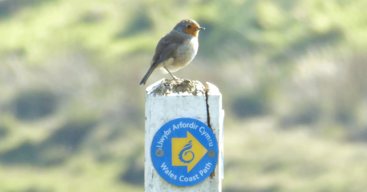
Next was a walk around Cocksburn Reservoir. On the track up to the reservoir a very tame little robin joined me and hopped alongside me for a few metres before flying off into the wood. I was heading into a tourist honey pot area, there were a few people walking around the reservoir then just afterwards there was a car park at the bottom of a path up to the summit of Dumyat (dum- eye-at) 418m/1371ft. A popular climb for locals with a beacon, trig point and memorial at its summit, plus amazing 360 degrees views over Stirling, the Wallace Monument, Stirling Castle and the Forth estuary, plus views of the Ochil Hills. The climb wasn’t too strenuous, the trail had benefited from a fair bit of maintenance work recently to sections of it which made the climb a bit easier, plus with all the dry weather there were no muddy or boggy sections. The views were fantastic, albeit a little bit hazy over the Forth. I stopped at the summit for a while and sat sheltered out of the wind on the north side admiring views of the Ochils for a snack break.
.jpg) Most visitors to Dumyat return back down the same path, I continued east however descending down a very steep grass slope from the summit to Menstrie village. I passed a very pretty village green with an impressive metal sculpture – a boy with a foxes head sat on a water wheel.
Most visitors to Dumyat return back down the same path, I continued east however descending down a very steep grass slope from the summit to Menstrie village. I passed a very pretty village green with an impressive metal sculpture – a boy with a foxes head sat on a water wheel.
.jpg) From Menstrie the trail was back on the level for a while following a minor cycle and walking friendly lane all the way to Alva village. These villages (Menstrie, Alva, Tillicoultry and Dollar) are known as the Hillfoots Villages because of their location at the base of the Ochil Hills. There were some amazing houses along this lane against the magnificent backdrop of the Ochils, plus Broomhill Castle, built privately in 1874 in the style of Balmoral Castle and now a hotel. The castle could be seen between a couple of houses where I could hear bagpipes playing. I daren’t take a photo though as a lady was sunbathing on a sun lounger at a house in front of the castle, I thought it would be too rude to start pointing a camera in her direction!
From Menstrie the trail was back on the level for a while following a minor cycle and walking friendly lane all the way to Alva village. These villages (Menstrie, Alva, Tillicoultry and Dollar) are known as the Hillfoots Villages because of their location at the base of the Ochil Hills. There were some amazing houses along this lane against the magnificent backdrop of the Ochils, plus Broomhill Castle, built privately in 1874 in the style of Balmoral Castle and now a hotel. The castle could be seen between a couple of houses where I could hear bagpipes playing. I daren’t take a photo though as a lady was sunbathing on a sun lounger at a house in front of the castle, I thought it would be too rude to start pointing a camera in her direction!
On reaching Alva the trail entered back into woodland briefly, alongside Alva Glen, ascending to reach and cross open hillside before dropping down into Wood Hill Wood. This wood was absolutely beautiful in the dappled sunlight and I saw so many deer here, they are obviously used to people walking through, however they still kept their distance so not easy to get a good photo. Eventually the trail descended and came out past Tillicoultry Golf Course to reach Tillicoultry.
.jpg)
Another pleasant day of walking, the first 3 miles of trail from Tillicoultry to a Dollar followed a paved dismantled railway walking and cycle track – The Devon Way. Despite being paved it was pleasant walking and shaded in places by track side trees. There were lots of rabbits grazing on a grassy area of parkland and being a Saturday quite a few bikes whizzed past me. Dollar looked a pretty village in the shadow of Castle Campbell, a medieval castle formerly known as the Castle of Glooms, situated on the hillside above Dollar Glen, which has connections to Mary Queen of Scots.
From Dollar the trail climbed up alongside Dollar Glen, a very pretty wooded gorge which has been explored by visitors since Victorian times. There were smells of wild garlic wafting through the air. To help with access through the gorge quite a few bridges and steps have been built. Usually the gorge would have plenty of dramatic cascading waterfalls, but not whilst I was there during the prolonged dry spell. At the top of the glen is the entrance to Castle Campbell. I didn’t go in but the entrance fee was reasonable at £6 for an adult.
.jpg) After the lovely cool surroundings of Dollar Glen I was back out into the open and climbed up onto the hillside to reach Cadgers Gate. An ancient path leading to Auchterarder, once used by Cadgers (or Packmen) who were itinerant traders selling to people in remote areas. They would have used the higher route to avoid paying tolls on a lower valley toll road. The route passed through newly planted forest then contoured through the hillside encased by steep sided hills on the left and mature forest on the right before dropping down into Glen Quey, with views of Glen Quey reservoir ahead.
After the lovely cool surroundings of Dollar Glen I was back out into the open and climbed up onto the hillside to reach Cadgers Gate. An ancient path leading to Auchterarder, once used by Cadgers (or Packmen) who were itinerant traders selling to people in remote areas. They would have used the higher route to avoid paying tolls on a lower valley toll road. The route passed through newly planted forest then contoured through the hillside encased by steep sided hills on the left and mature forest on the right before dropping down into Glen Quey, with views of Glen Quey reservoir ahead.
.jpg) There was one lone fisherman on the shallow banks of the reservoir, from Castle Campbell I’d seen no one else. Get away from the towns and villages and the popular tourist spots and this trail is very quiet, you’ll hardly see another soul. After the reservoir the trail continued past a farmhouse and sections of woodland dropping down to Glendevon.
There was one lone fisherman on the shallow banks of the reservoir, from Castle Campbell I’d seen no one else. Get away from the towns and villages and the popular tourist spots and this trail is very quiet, you’ll hardly see another soul. After the reservoir the trail continued past a farmhouse and sections of woodland dropping down to Glendevon.
Today was probably the toughest day of the walk but also spectacular. My kind of walking, I saw no one else all day walking across beautiful but remote moorland sections, which were challenging in places. It started off slightly cloudy but the sun soon burnt off the cloud. From Glendevon the path climbed steadily uphill onto open moorland heading for Cadgers Yett pass, the highest point of the trail at 435m (1425 ft). It passed by the wind turbines of Green Knowes Wind Farm, the wind turbines were whistling away. Some people hate the turbines, I think they look quite majestic and don’t mind them.
.jpg) From the pass the track descended down, still across moorland, to Coul Burn then up again to join Coul Glen Track. This headed gradually uphill again, passing a herd of brown cows on the way kicking up dust, to reach another pass before gradually descending through a steep sided glen, Corb Glen.
From the pass the track descended down, still across moorland, to Coul Burn then up again to join Coul Glen Track. This headed gradually uphill again, passing a herd of brown cows on the way kicking up dust, to reach another pass before gradually descending through a steep sided glen, Corb Glen.
.jpg) After this splendid moorland section is was back into forest following paths and forest tracks and a new path across a couple of burns through the woodland, linking one forest track to another. The forest had been felled in many places so there were good views to be had. On joining the other forest track there were some conveniently placed large felled tree stumps which made for a makeshift picnic table and chairs for a break. The trail continued through the forest for a further 2.5 miles.
After this splendid moorland section is was back into forest following paths and forest tracks and a new path across a couple of burns through the woodland, linking one forest track to another. The forest had been felled in many places so there were good views to be had. On joining the other forest track there were some conveniently placed large felled tree stumps which made for a makeshift picnic table and chairs for a break. The trail continued through the forest for a further 2.5 miles.
.jpg) Following a short road section with a 'drive slowly - red squirrel crossing' warning, it was back onto open moorland again following a track uphill. At the top of the hill the trail left the track and headed across open trackless moorland. On a clear day like I had, navigation was not a problem, I could see Tillyrie Hill ahead and a lone larch tree which were my navigational markers. On a misty or cloudy day a map and compass would be required. The worse obstacle was a rickety old stile onto the moorland section which unexpectedly toppled over, the fence with it too, as I stood on the far side of it; ripping my trousers on some rusty barbed wire resulting in a small cut and bruising around my knee - I hoped my tetanus jab was up to date! Once across the moorland the trail took you on a narrow route between two large high deer fences to emerge at another smaller plantation. There had been a lot of recent activity in this area, plus lots of new deer fencing erected, which was quite confusing, but I found my way eventually.
Following a short road section with a 'drive slowly - red squirrel crossing' warning, it was back onto open moorland again following a track uphill. At the top of the hill the trail left the track and headed across open trackless moorland. On a clear day like I had, navigation was not a problem, I could see Tillyrie Hill ahead and a lone larch tree which were my navigational markers. On a misty or cloudy day a map and compass would be required. The worse obstacle was a rickety old stile onto the moorland section which unexpectedly toppled over, the fence with it too, as I stood on the far side of it; ripping my trousers on some rusty barbed wire resulting in a small cut and bruising around my knee - I hoped my tetanus jab was up to date! Once across the moorland the trail took you on a narrow route between two large high deer fences to emerge at another smaller plantation. There had been a lot of recent activity in this area, plus lots of new deer fencing erected, which was quite confusing, but I found my way eventually.
.jpg) Descending off Tillyrie hill bought a few more challenges, a new barbed wire fence to climb over plus trying to find a faint path through heather. I failed, so just walked across the heather, off piste, to my next goal, a disused quarry now a Lochan. Here was another new barbed wire fence to climb over, again I was glad I had my foam pad! The last 2.5 miles were an easy quiet lane section to Glenfarg. A challenging but very rewarding day.
Descending off Tillyrie hill bought a few more challenges, a new barbed wire fence to climb over plus trying to find a faint path through heather. I failed, so just walked across the heather, off piste, to my next goal, a disused quarry now a Lochan. Here was another new barbed wire fence to climb over, again I was glad I had my foam pad! The last 2.5 miles were an easy quiet lane section to Glenfarg. A challenging but very rewarding day.
This was my final day of walking, I wished I was continuing on to St Andrews as the Mary Queen of Scots Way exceeded my expectations, but sadly I didn't have time. I’ll have to come back to complete the last stage. This final day was a good end however. The weather wasn’t quite so good, the sun had gone and been replaced with drizzle initially and low cloud, but it was a better temperature for walking, around 14/15 degrees instead of 24/25.
The route followed farm tracks across farmland for the first few miles out of Glenfarg heading for the Lomond Hills. The trail passed through a pleasant woodland section alongside Glen Burn before entering into the picturesque Glen Vale. Obviously a popular route as the footpath was very well maintained, being a Monday however there were only a handful of people around. The cloud shrouding the hilltops looked quite atmospheric, scenes you expect in Scotland rather than the clear blue skies I’d been lucky enough to have all week. The trail climbed steadily heading for a pass between West Lomond and Bishop Hill. Near the pass was a craggy outcrop, John Knox’s Pulpit, which the trail passed beneath.
.jpg) From here the trail continued through a small patch of forest to reach Harperleas Reservoir before following a track descending to a road. I then joined a path descending through Maspie Den, a beautiful gorge walk following closely beside Maspie Burn. The trail takes you behind a waterfall, Yad waterfall, which was more of a trickle when I was there, and descended across numerous bridges down through the pretty gorge. Being Scottish school holidays it was very popular with families out for a walk. Nearing the bottom of the gorge the path took you through a short but curved tunnel. The guide book said there should be just enough light to see through. As I entered it, it was pitch black and I couldn't see a thing, so I used my phone torch. Maybe if you’ve been through the tunnel before you know what to expect and don’t mind a brief second or two blackout!
From here the trail continued through a small patch of forest to reach Harperleas Reservoir before following a track descending to a road. I then joined a path descending through Maspie Den, a beautiful gorge walk following closely beside Maspie Burn. The trail takes you behind a waterfall, Yad waterfall, which was more of a trickle when I was there, and descended across numerous bridges down through the pretty gorge. Being Scottish school holidays it was very popular with families out for a walk. Nearing the bottom of the gorge the path took you through a short but curved tunnel. The guide book said there should be just enough light to see through. As I entered it, it was pitch black and I couldn't see a thing, so I used my phone torch. Maybe if you’ve been through the tunnel before you know what to expect and don’t mind a brief second or two blackout!
.jpg) Leaving Maspie Den it was a ten minute walk down the road into the pretty conservation village of Falkland with its centuries old houses and palace, gift shops, pubs and cafes. A very popular tourist village.
Leaving Maspie Den it was a ten minute walk down the road into the pretty conservation village of Falkland with its centuries old houses and palace, gift shops, pubs and cafes. A very popular tourist village.
Contours Holidays pride ourselves on our expert knowledge of the UK’s trails. We regularly set out to check our routes and directions and to make improvements on the holidays we offer. You can find several write-ups of staff expeditions in our Trail Diaries.