Which Way is Home? How to Use a Compass
Compass skills allow you to walk the countryside much more safely. Learn the basics here.
Which Way is Home? How to Use a Compass
https://www.contours.co.uk/which-way-is-home-by-sarah-rowell
One of the benefits of having a lifestyle that takes me to different places is the opportunity to explore new surroundings. Whether I’m in the city, urban areas, countryside or wilderness there are usually (and in the case of the latter, always) trails of some sort to explore.
And while occasionally there may be maps and well-marked trails to guide you, just as often it is a case of heading out of the door to see what you can find. At this point anything other than a straight route takes on a bit of added adventure. Okay, walking or running in American cities tends to be easy, given the box-like layout of their roads, but try that pretty much anywhere else and, no matter how experienced you are, you soon realise that the human internal navigation system is not that great – even after 35 odd years of trail exploring, mine certainly is not. Many are the time I have set out to go for a short run, got into the countryside and worked on a system of one way turning (i.e. either all right or all left turns) to try to get me back to where I started. On a clear day with good fixation points to use as anchors (such as a certain building, hill or similar) things usually work out okay. However when the mist is down, or you find yourself in featureless terrain or woodland, it normally means a longer outing than planned, while hoping you can find someone to help get you back on track or experiencing a quick minor moment of blind panic.
Take the time last year when I was staying in Betsy-coed where we were due to host the World Mountain Running Championships later in the year. I set out for an evening run into the forested area on a carefully planned route, taking the map and my head torch but not a compass. While the first part of the run went smoothly, the mix of twisty windy paths and additional logging tracks (which did not match up to those on the map) soon meant I literally had no idea where I was, and of course lacking a compass I could but guess which way was south or east (in order to find a road). Suffice to say that after jogging around for long enough, a cluster of lights in the darkness drew me to a farm building, which enabled me to work out where I was on the map. I made it back safely and only 60 minutes late; at least my mistake was not as serious as a couple of runners the day before, who went out to recce the course, got lost and returned 90 minutes later after what should have been an easy 30 minute jog.
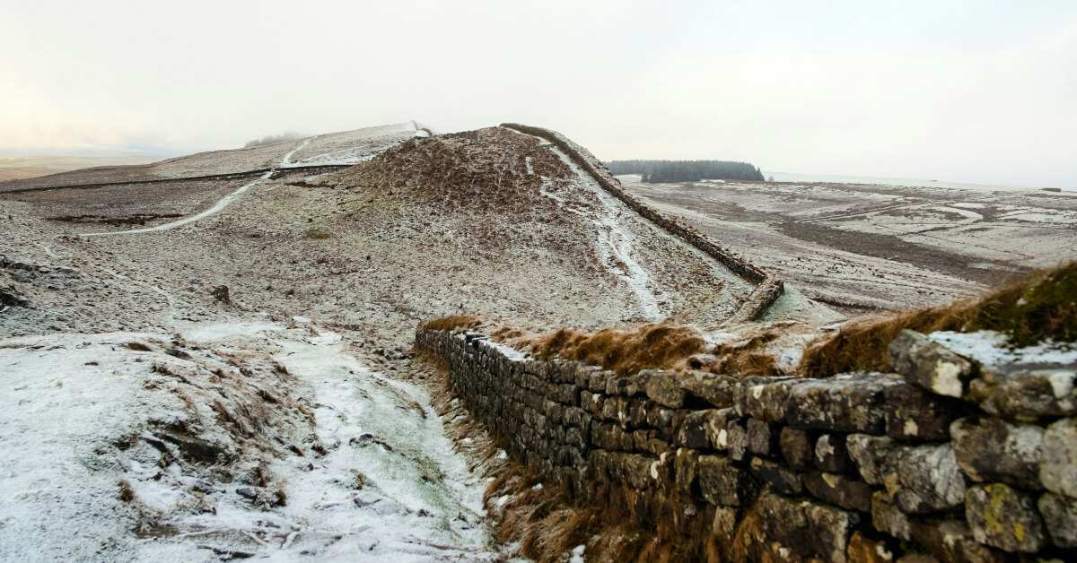
It is not just unknown territory where this can happen. One of my favourite walks/runs for example is up onto the Pennine Way, past Wuthering Heights and dropping down to the three Walshaw Dean Reservoirs. Even in the mist, the newish paving slabs mean the route cannot be lost. Come winter however, and the snow makes it a different matter. By the time you get up on to the flat, featureless top in dull light or mist, it is not finding the path which is the challenge, but just making sure you head in sort of the right direction and do not veer off to the left or right, in either of which case you just end up floundering around in knee-high tussocks all hidden by snow.

All of which is a long way of saying that whatever walking you do, whether on marked trails or totally off-track, owning, carrying and knowing how a compass works should be non-negotiable for all walkers. Anyone still not convinced should check out what happened to the women who took part on The Island reality show, who ended up walking around in a circle three times rather than a straight line.
“Arh,” I hear many people saying, “I have a GPS/a sat nav system on my phone, so I have no need for the simple ways of a compass,” and on many occasions – certainly as far as GPS is concerned – that may well be true. However as any half serious walker should know, a mobile phone should never be relied on to have a strong enough signal to be able to use any mapping software.
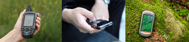
Even with GPS units there is need for care. Cold weather will put an increasing demand on their battery and drastically shorten their working lives. As well as this, in order for the GPS to work it must be able to fix against at least four satellites to enable it to provide an accurate position; this can take up to 20 minutes in some areas, particularly those which are heavily built up or wooded.
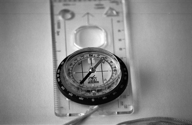
On the other hand, a compass requires nothing more than the Earth’s magnetic field to provide an accurate picture of which way you are facing, and that is often all you need to be able to relocate yourself or get yourself back to where you need to be. While there are numerous models and makes of compass on the market, they all contain a magnetic needle which always points north (even the compass on an iPhone does this as well!) The only time this does not apply is in a few areas, such as in some parts of Northern Scotland, where the strength of the magnetic field is such that it disturbs the natural positioning of the needle.
As shown above, the magnetic needle is contained in a casing with a rotating bevel marked every quarter with South, North, East and West, plus 360 degree markers in-between. If you know that the red needle always points north, then by rotating the bevel to match the N, the compass (and you) are also now pointing north. So if you know which direction North is, you automatically know where South, West and East are, and therefore hopefully the direction in which you need to travel to ensure that you stay on route, or get back onto it if you’re lost.
In many cases you ideally want a more accurate reading than simply North, South, East or West, and so the real power of the compass comes when you combine it with a map. If you know where you are on the map and which direction you want to travel in, and you know which way is North, then irrespective of being able to see much you can quickly and easily do what is called ‘taking a bearing’, which will then give you the direction you need to travel in.
Although it can sound a little daunting at first, taking a bearing is not difficult and with practice will quickly become second nature. To take a bearing, place the compass on your map with the base plate parallel to the direction that you want to walk in, making an imaginary straight line between where you are and where you want to be (in the case below I want to travel down towards the reservoir on the map):
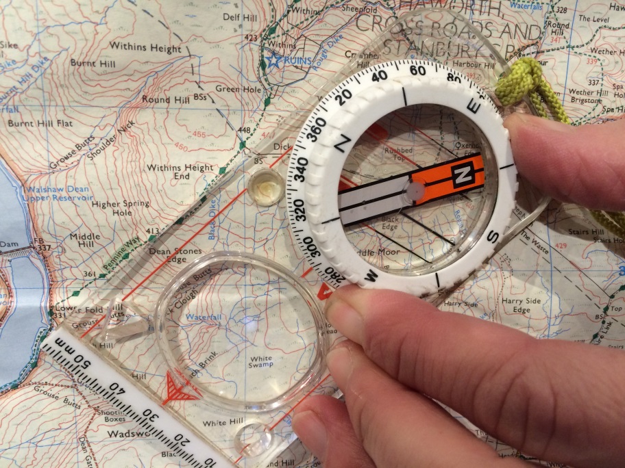
Now rotate the compass housing so that the lines painted inside the housing (the meridian lines) are aligned to the grid lines on the map with the red ends pointing North on the map:
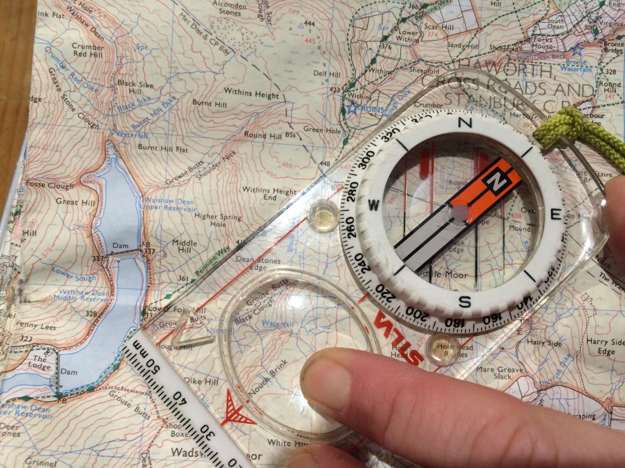
Held like this, the direction of travel you need to go in is given by the bearing number – 228 degrees. Now, without turning the compass bevel, rotate yourself, the map and the compass together until the north arrow is lined up with the meridian lines. Your direction of travel is given by the direction of the travel lines (in this case, South West):
To walk in the direction you want to go, you now have two options to help you; you can either walk with the compass flat on your hand while keeping the arrows aligned, or alternatively you can stand so that the arrows are all aligned and, following the direction of travel, look ahead to pick a feature (e.g. a bush, tree or rock etc.) which is in your direct line of sight. Walk towards your chosen feature and repeat.
Of course not all errors of direction can be blamed on a lack of knowledge. For example a friend and I once walked for 2 hours up a long South-West facing valley in the Lake District before finally conceding we were in the one parallel to our planned outing. The fault here lay in our too-hasty map reading, which I will cover in my next article, so make sure to keep an eye on the Contours blog!