Walking the Anglesey Coast Path
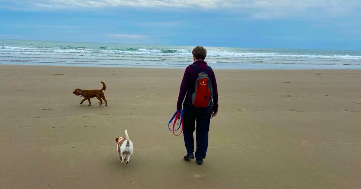
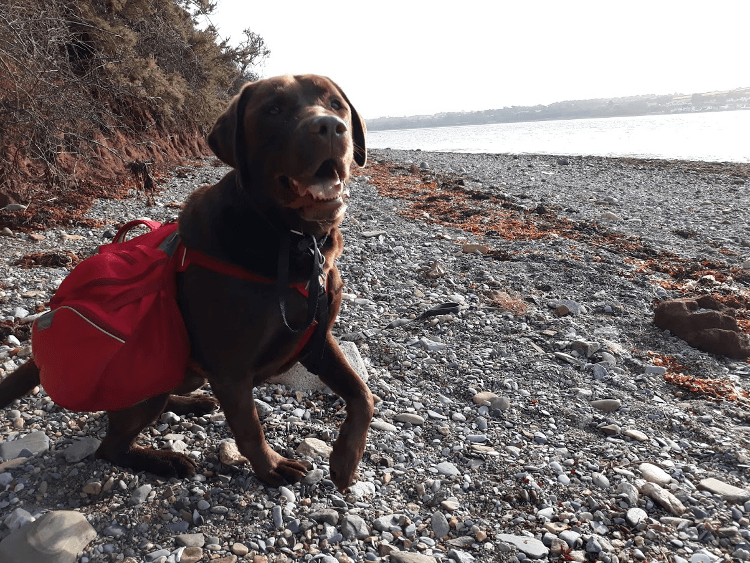
Training for longer walks, Christine takes her dog Gino for a hike along the Anglesey Coast Path.
Walking the Anglesey Coast Path
https://www.contours.co.uk/walking-the-isle-of-anglesey-coast-path
by Christine Saul
 In September 2020, very much still in the middle of the COVID-19 pandemic, but whilst holidays were allowed to go ahead, myself and my dog Gino managed to enjoy a few delightful days walking part of the Anglesey Coastal Path.
It was Gino’s first multi-day walking trip and he absolutely loved it.
The Anglesey Coast Path had been on my bucket list for a few years, so I was very excited to finally get the chance to walk a section of it.
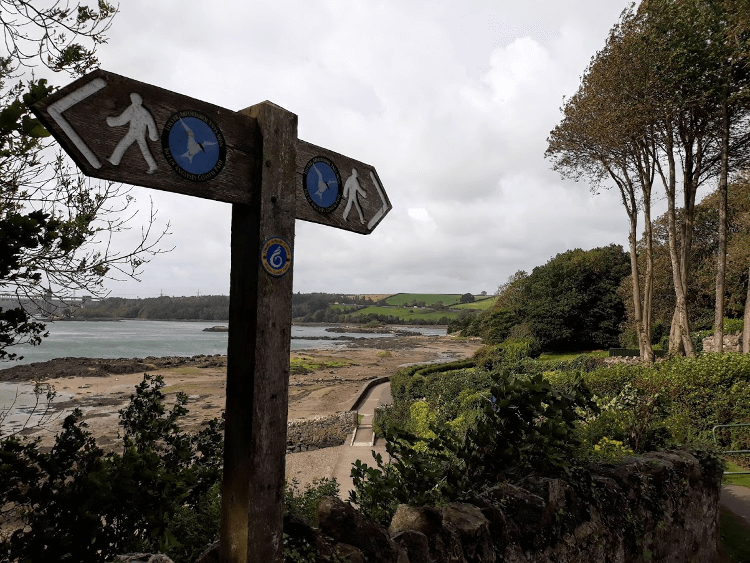
We started from the beautiful town of Beaumaris on the Menai Strait, which has far-reaching views across the strait to the Snowdonian mountains. It was a bit overcast, however, so the views weren’t at their best for us.
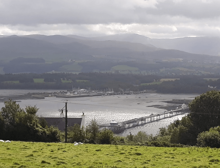
Heading south from Beaumaris, we climbed to follow an inland hillside route high above the Menai Strait. From here, there were good views of the strait, the Snowdonian mountains and Bangor Pier strutting into the strait from the opposite bank. From the hillside, the pier looked like it almost reached our side!
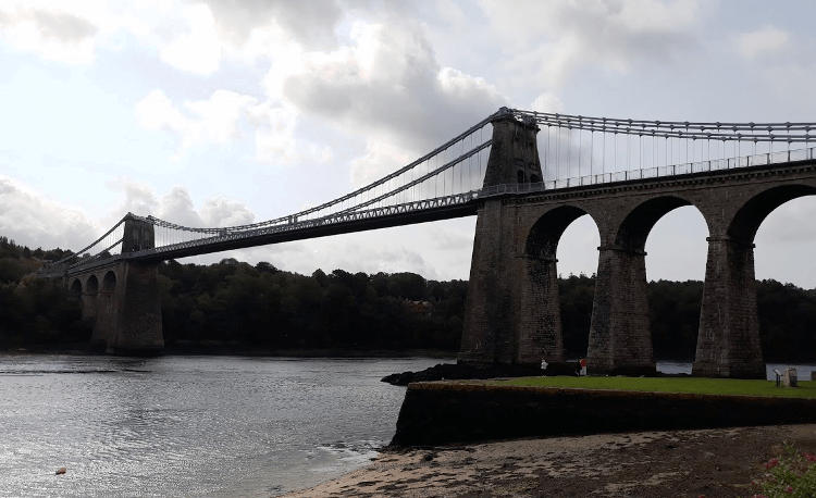
After about four miles, the trail dropped down to reach the town of Menai Bridge, home of the famous Menai Suspension Bridge built by Thomas Telford between 1819 and 1826. The trail went right under the Menai Bridge and then joined the popular Belgian Promenade walkway.
This was a beautiful section of the trail alongside the strait all the way to Britannia Bridge. The Belgian Promenade was built by a group of Belgian refugees who found asylum in Menai Bridge in 1914. They built the promenade as a thank you to local residents for providing them with food and shelter.
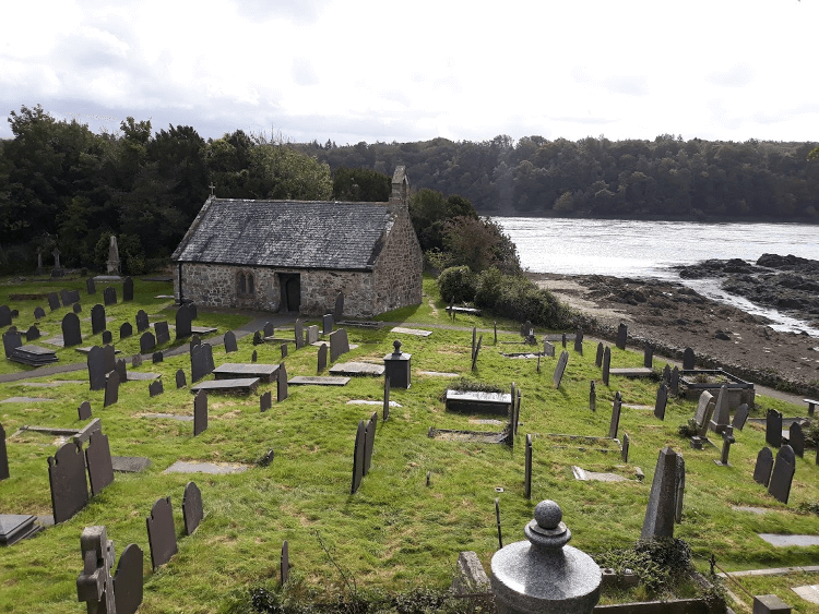
A short detour off the promenade took us to a quaint little church, Tysilio’s Church, and graveyard on its own small island (Church Island) jutting into the strait and shadowed by both the Menai Suspension Bridge and Britannia Bridge.
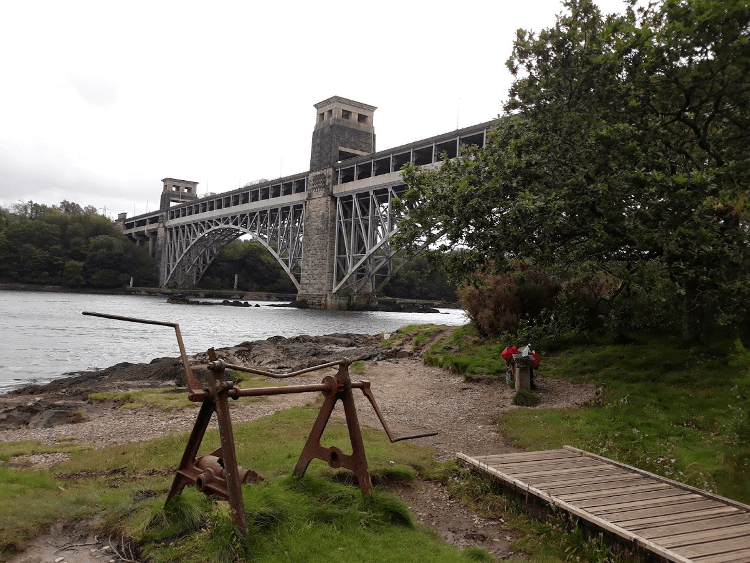
The trail continued alongside the strait, close to the shore through National Trust woodland and over boardwalks to reach the Britannia Bridge, where we stopped for some lunch on a bench.
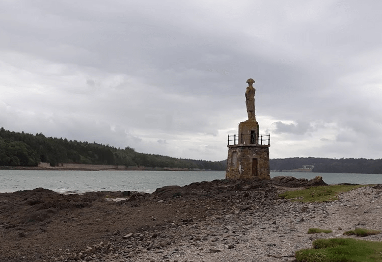
Passing under the bridge, we walked through a small churchyard to reach the rocky shores of the Menai Strait. We followed it for about half a mile, passing a statue of Admiral Nelson that was erected at the water’s edge as a marker for shipping.
Through a pretty little harbour, the trail headed inland through farmland for the next six miles, sometime along the road, before returning to the shores of the strait.
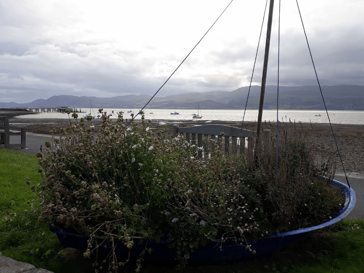
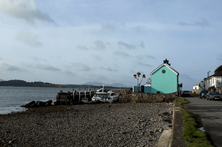
It was more pleasant walking along the shores of the strait again, passing Anglesey Sea Zoo and a quaint blue-painted house (a former pub) that had its own little private harbour and boat.
The high tide line was clearly visible on the shore. We were lucky and the tide was out; if it had been in, there wouldn’t have been much negotiation room along the shore.
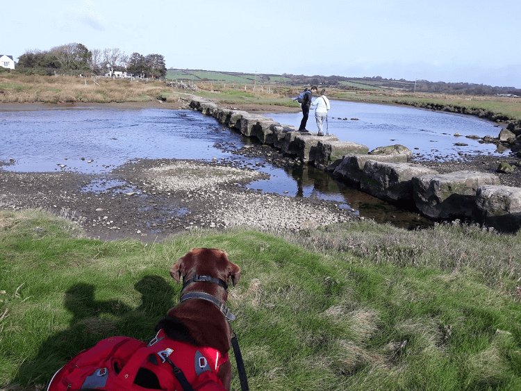
The trail headed inland again, heading towards the famous Afon Braint stepping stones on the outskirts of Newborough village.
They are huge, the biggest stepping stones I’ve ever seen, most probably around a cubic square metre in size each. Gino did an amazing job of hopping over them. We could both fit on one stone together at the same time.
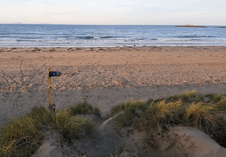
Shortly afterwards, we reached Newborough Forest, a large recreational pine forest, and Newborough Warren Nature Reserve, the first coastal Natural Nature Reserve in Wales. The nature reserve encompasses a vast area of sand dunes, one of the largest in Britain. The trail followed a path between the forest and the dunes all the way to the beautiful expansive sandy coast at Llanddywyn Bay.
We walked along the beach briefly to the main forest car park. Dogs were not allowed on most of the beach here, which was a shame as it meant we couldn’t go and visit the popular Llanddywyn Island, a small narrow peninsula housing an attractive lighthouse near the southern entrance to the Menai Strait.
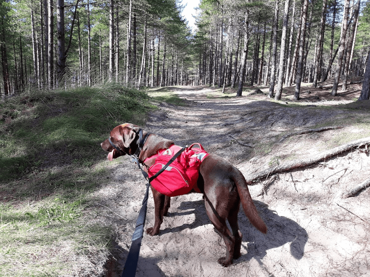
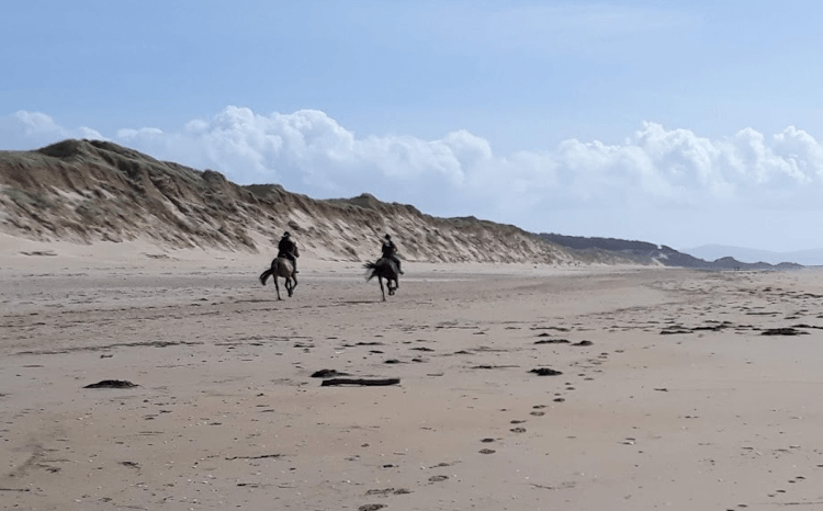
We walked along shady forest tracks until we were allowed access to the beach again (the official path continued through the forest). We wandered along the long expansive sandy beach for a couple of miles, passing an old shipwreck and a couple of horse riders having a good gallop, until we headed back into the forest again at Malltreath Sands.
Gino loved the freedom of the beach and this section was very quiet, allowing him to have a good run around off the lead.
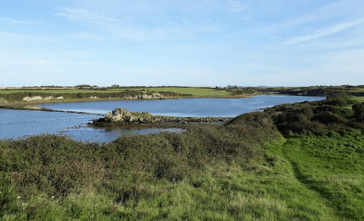
Newborough Forest is said to have a large red squirrel population, but we sadly didn’t see any. The trail continued along forest tracks, which were busier now with other visitors, to reach the mile-long Pen Cob embankment on the way to Malltreath, which had great views down the Cefni Estuary.
From Malltreath, the trail headed inland again for about four miles along quiet lanes. We passed the Bodorgan Estate, where Prince William and Kate, The Duke and Duchess of Cambridge, lived in a farmhouse during William’s time working at RAF Valley as a helicopter pilot.
We reached another large expanse of sand dunes just before Aberffraw. We were planning on walking through the sand dunes to reach Treath Mawr beach, which is supposed to be one of the best beaches on the island, but a very strong wind had developed and sand was blowing around, unpleasantly getting in eyes, so we headed across the dunes directly to Abberffraw village instead.
The following morning, the winds were still very strong, which meant rough seas and dramatic scenes of waves crashing against the rocky coast as we walked from Abberffraw to Rhosneigr.
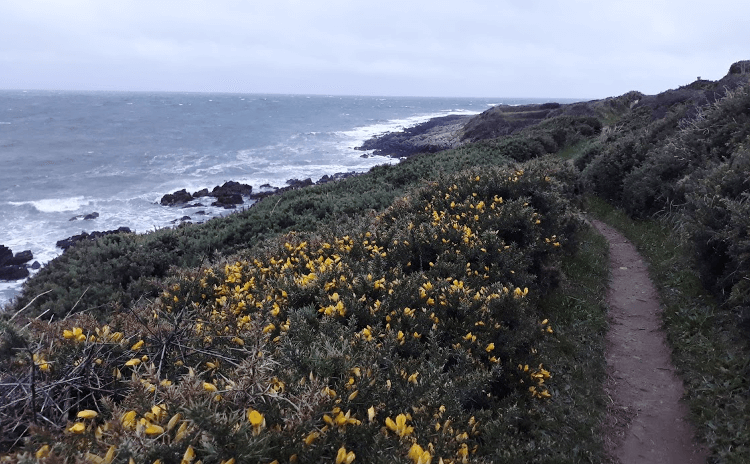
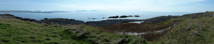
Although quite wild with the strong winds, this was a lovely remote section of the Wales Coast Path that ran along gorse-lined rugged coast paths. We reached Porth Cwyfan bay, which had another tiny church on a small island jutting out into the sea accessed by a small rocky causeway.
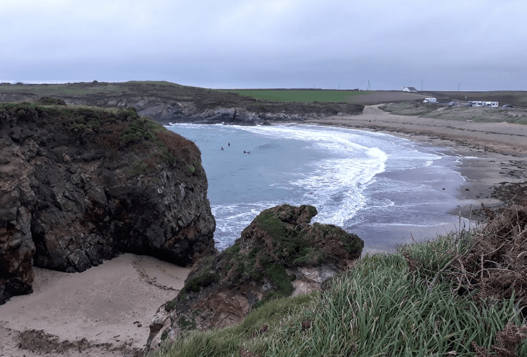
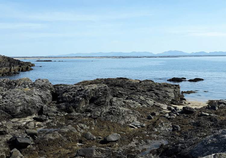
After an inland detour of about a mile to get around Anglesey Motor Racing Circuit, we were back on the rugged coast again to Trecastell Bay, where some early morning surfers were making the most of the swell and choppy waves. The car park also seemed to be a popular overnight stop for lots of motorhomes!
On the headland just past Trecastell Bay, directly on the trail, there is Barclodiad y Gawres, a Neolithic burial chamber c.2500bc with stones decorated with spirals and zigzags. The stones, behind iron bars, were lit up, but it wasn’t easy to see the decorations.
Just before entering Rhosneigr, we passed a bench with a large plaque on it, sponsored by Kingsmill bread/Visit Wales, proudly announcing that its position was voted as one of the UK’s top ten lunch spots in 2013. It was a pretty spot but I’m sure there are far more worthy location contenders!
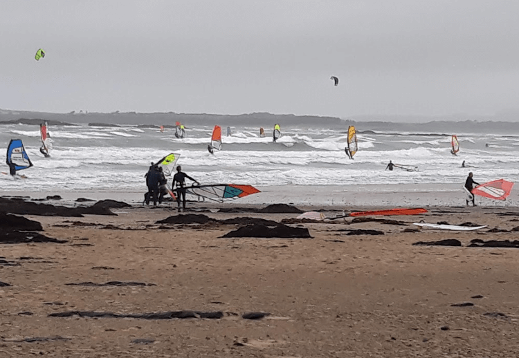
Arriving in Rhosneigr, the beach was buzzing — and the village too, with every possible road parking space taken — with windsurfers and kite surfers getting their surf fix and taking advantage of the one day of strong winds. It was quite an amazing sight.
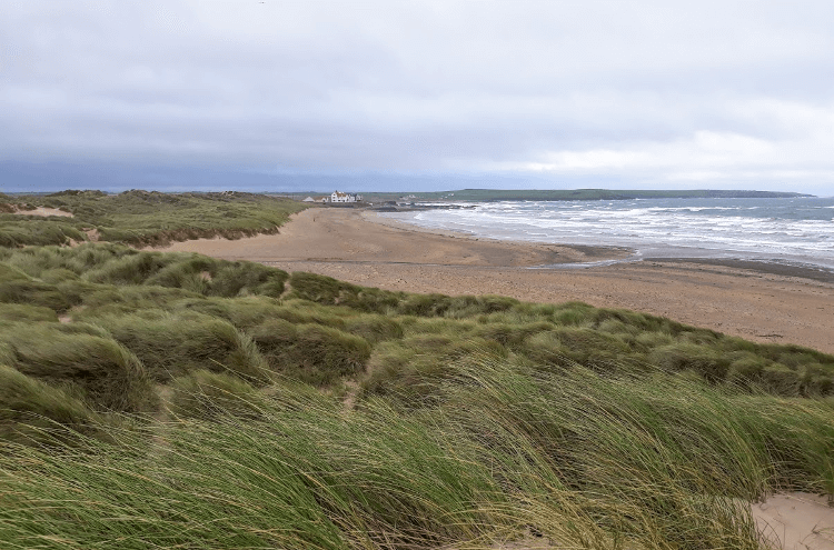
We left Rhosneigr through sand dunes and emerged onto another lovely long sandy beach, Traeth Cymyran. We walked along for about half a mile before turning to head inland past RAF Valley, where fighter jets were taking off regularly, much to the delight of a handful of plane spotters. They were constantly flying overhead for the rest of the day all the way to Trearddur Bay.
If you could continue following the coast exactly, Trearddur Bay would be only about 6.5 miles from the turn to RAF Valley. However, a seven-mile, almost horseshoe-shaped inland route is required to navigate around and over the tidal sands separating Holy Island from Anglesey at Four Mile Bridge, and you arrive only half a mile from where you were previously by RAF Valley. That makes it 13.5 miles to Trearddur.
The walking around the tidal sands was still interesting and varied, crossing through farmland, past small creeks, over small causeways, through woodland and following lots of boardwalk over salt marsh. We emerged back at the coast at a stunning sandy beach at Silver Bay where Gino enjoyed a cool off in the sea as it was a hot day.
From here, it was back onto rugged heathland paths following the coast past another pretty sandy bay, Borthwen, where Gino had another dip and me a paddle. Between pretty white-washed cottages near Rhoscolyn, we climbed up to a coastguard lookout tower. The views from here were amazing. It was a clear day so we could see for miles over Caernarfon Bay to the Llŷn Peninsula.
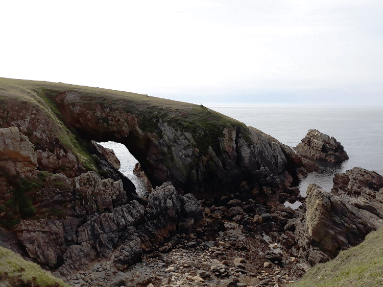
The trail continued along grassy rugged cliff tops, passing rocky coves and a couple of natural rock arches before crossing a caravan park and following the road to the popular village of Trearddur Bay, sitting on a beautiful tranquil bay, which sadly marked the end of our walk for this time.
It had been a long hot day so we celebrated resting on the beach in the late afternoon sunshine with an ice cream each. Gino amazingly found more energy from somewhere and joined in with some local dogs for a doggie play on the beach.
We’ll be back to complete the rest of the island hopefully very soon.
Contours Holidays pride ourselves on our expert knowledge of the UK’s trails. We regularly set out to check our routes and directions and to make improvements on the holidays we offer. You can find several write-ups of staff expeditions in our Trail Diaries.
Interested in walking the Anglesey Coast Path yourself?
Contours Holidays offer four versions of the Anglesey Coastal Path walking holiday: the full route, North section, South section and short break. Find your holiday here: