Highlights of the Offa's Dyke Path in Autumn
Contours walk Offa's Dyke Path over a crisp week in autumn.
Highlights of the Offa's Dyke Path in Autumn
https://www.contours.co.uk/highlights-of-the-offa-s-dyke-path
by Christine Saul
As one of the UK's 15 National Trails, the Offa's Dyke Path has been on my 'to do' list for a few years. This summer I finally got the chance to walk this very popular trail, and it lived up to all of my expectations. It's right up there with my other favourite UK trails, including Wainwright's Coast to Coast, the Pennine Way and the Cleveland Way. The contrasts in scenery and terrain are diverse, passing through the wooded Wye Valley AONB, over Hatterrall Ridge in the Brecon Beacons National Park, through the Shropshire Hills AONB, along the Llangollen Canal and Pontcysyllte Aqueduct and through the Clwydian Range AONB.
The trail runs for 177 miles alongside the border between England and Wales, starting from Sedbury Cliffs on the Severn Estuary at Chepstow and finishing on the north coast of Wales at Prestatyn. The trail crosses the English/Welsh border over twenty times, and passes through eight different counties. There are no signs on the trail to advise if you are actually in England or Wales; you can only tell by looking at the map, or by the presence of dual language signs, to know if you are in England or Wales at any point.
Offa's Dyke is not an easy trail; it is in fact quite a challenge, and can be rather demanding as the trail continually undulates. The toughest sections are through the Black Mountains (Pandy to Hay), The Shropshire Hills (Knighton to Brompton Crossroads) and the Clwydian Hills (Llangollen to Prestatyn). Although the trail does not take you to any great heights through these mountain/hill sections, the average ascent per mile on this trail works out more than that for the Pennine Way or the Coast to Coast Walk. I definitely found Offa's Dyke Path more tiring than walking the Pennine Way, with all its ups and downs. That said, the way marking on the trail was outstanding compared to other trails and it was relatively easy to navigate; you still need your map and guide book though!
These were my favourite sections of the trail:
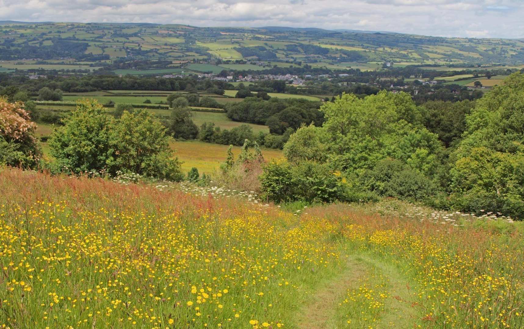
Just before dropping down to Bigsweir Bridge on the high level route, I passed some amazing and huge old chestnut trees adorned with fruit (conkers). One had a huge hollowed-out trunk and must have been hundreds of years old.
.jpg) From Bigsweir Bridge, the trail takes you high above the beautiful Wye Valley through lovely ancient woodland, namely Bigsweir Wood, Cadora Wood and Highbury Wood Nature Reserves. These woods are typical of the Wye Valley - they have been attracting visitors for centuries and form some of Britain’s most important areas of ancient, semi-natural woodland. I love walking through woods - there's always something special and magical about them, and they have a calming nature.
From Bigsweir Bridge, the trail takes you high above the beautiful Wye Valley through lovely ancient woodland, namely Bigsweir Wood, Cadora Wood and Highbury Wood Nature Reserves. These woods are typical of the Wye Valley - they have been attracting visitors for centuries and form some of Britain’s most important areas of ancient, semi-natural woodland. I love walking through woods - there's always something special and magical about them, and they have a calming nature..jpg)
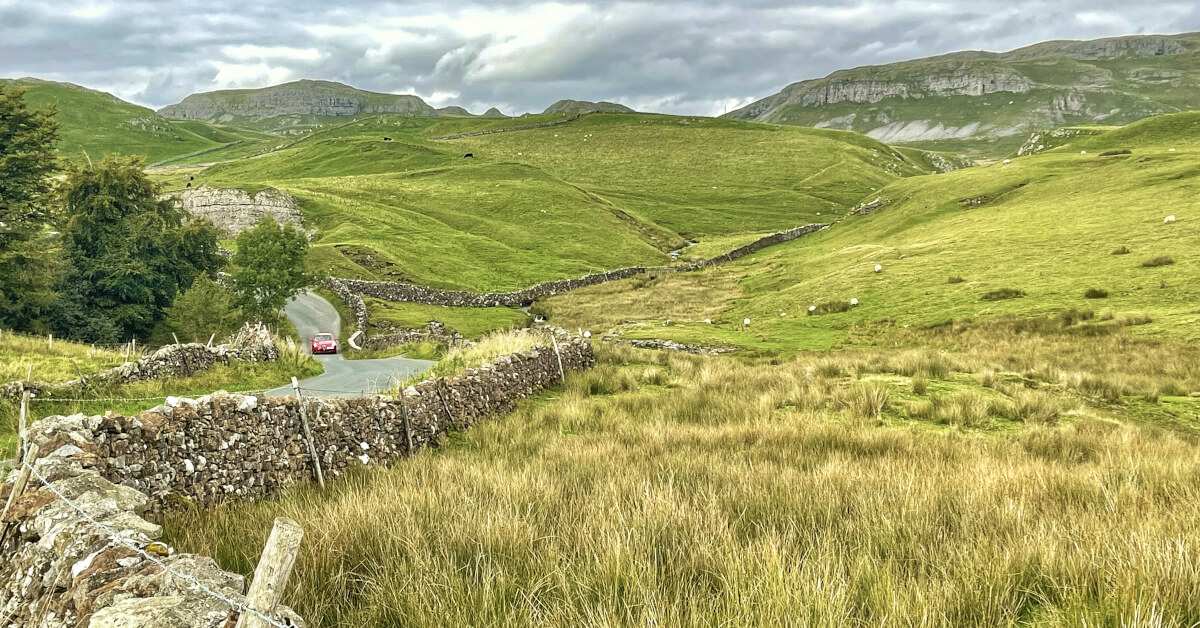
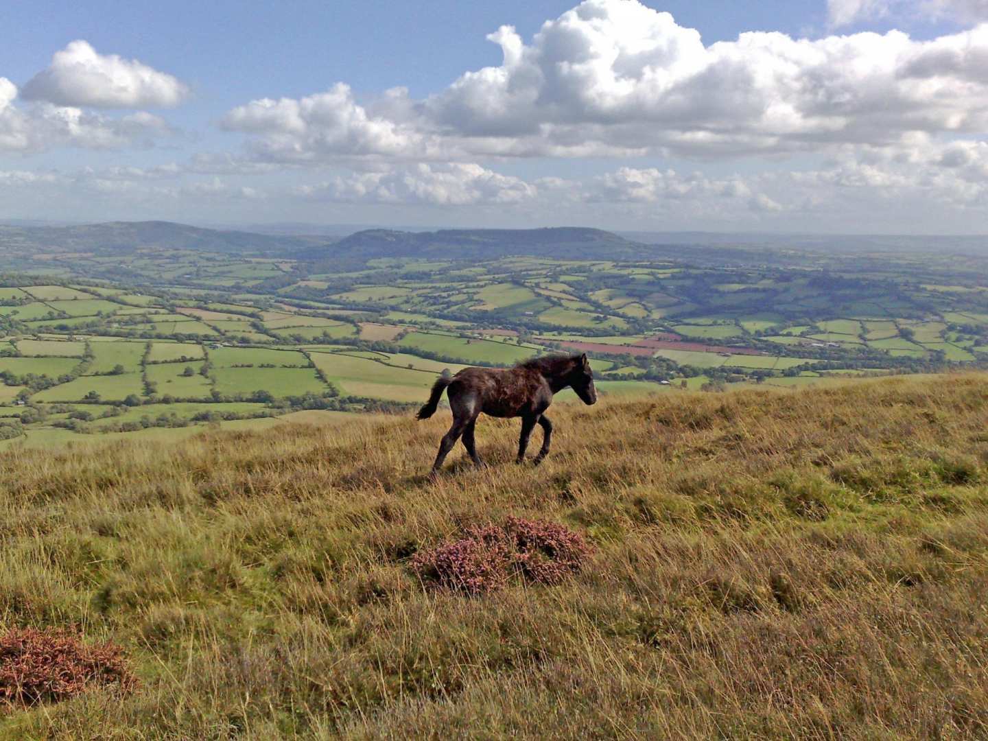
The 17-mile section between Pandy and Hay-on-Wye takes you over Hatterrall Ridge, a long spine of hills in the Black Mountains which separates England and Wales in the northeast area of the Brecon Beacons National Park. It is a fantastic day's walk and takes you over the highest point of the trail at 703m (2306ft). I didn't get a particularly good weather day for this section of trail; at 600m I was in the clouds with damp cloud and mist, so the views weren't great. On a good, clear day, the views would be fantastic. It was still quite dramatic though, and I got to view odd snippets of the valleys below as the clouds briefly cleared.
.jpg) There were lots of wild ponies on the ridge, as well as moorland birds and plenty of sheep. Although this is a long section, once you've climbed up onto the ridge the walking is fairly straight forward for around 10 miles, before descending down towards Hay-on-Wye.
There were lots of wild ponies on the ridge, as well as moorland birds and plenty of sheep. Although this is a long section, once you've climbed up onto the ridge the walking is fairly straight forward for around 10 miles, before descending down towards Hay-on-Wye.
.jpg)
Disgwylfa Hill, just after Newchurch, is a small but lovely section of bracken moorland. There was a farmer bracken-cutting as I walked through; they cut and dry the bracken, much like hay-making, and bale it up for animal bedding. This in turn allows for the grass to grow, which improves the grazing for sheep and the conditions for ground nesting birds.
.jpg) Shortly after Disgwylfa Hill is Hergest Ridge Common, with more spectacular walking. The trail follows the whole length of the ridge from Gladestry to Kington on an old drovers road across the common. Here again, farmers make bedding from cutting bracken and wild ponies and sheep graze the hills.
Shortly after Disgwylfa Hill is Hergest Ridge Common, with more spectacular walking. The trail follows the whole length of the ridge from Gladestry to Kington on an old drovers road across the common. Here again, farmers make bedding from cutting bracken and wild ponies and sheep graze the hills..jpg)
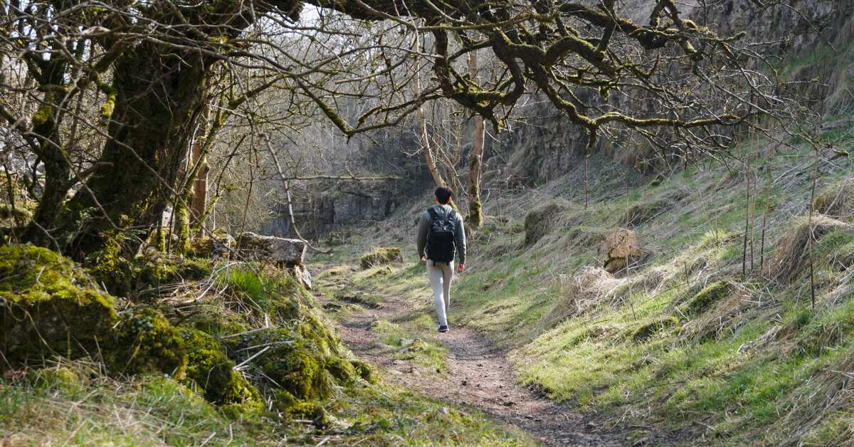
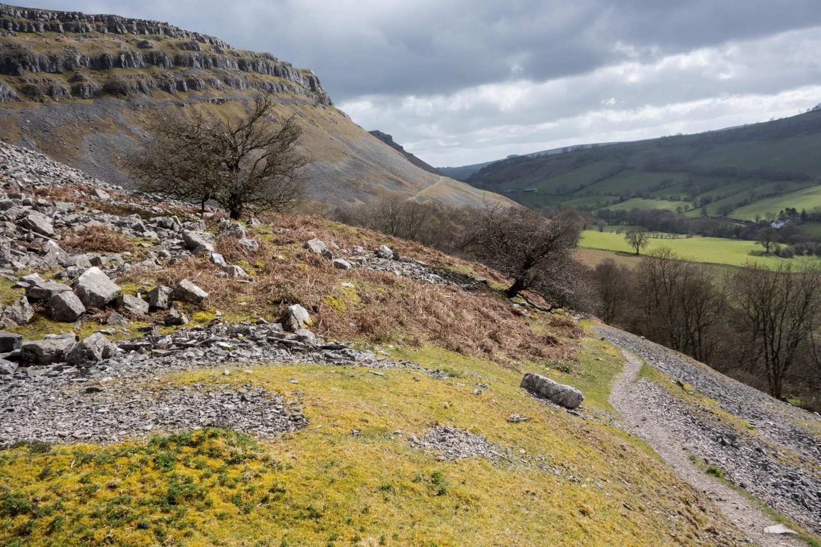
This is one of the toughest sections of the trail - a tiring but very rewarding day, taking you on a rollercoaster ride through the beautiful Shropshire Hills AONB.
.jpg) There is also a lot of the Dyke on view in this section, and a large part of the day is spent walking alongside or on top of the Dyke, which could be a grassy mound, tree-covered or gorse-covered in places. The Offa's Dyke earthwork only actually runs for 80 miles from the Wye Valley to Wrexham, and there are large sections that are visible, but other sections that have been long gone due to farming activity over many years. Just before reaching Newcastle on Clun, you pass the highest point of the Dyke - 432m (1417ft) - on Llanfair Hill.
There is also a lot of the Dyke on view in this section, and a large part of the day is spent walking alongside or on top of the Dyke, which could be a grassy mound, tree-covered or gorse-covered in places. The Offa's Dyke earthwork only actually runs for 80 miles from the Wye Valley to Wrexham, and there are large sections that are visible, but other sections that have been long gone due to farming activity over many years. Just before reaching Newcastle on Clun, you pass the highest point of the Dyke - 432m (1417ft) - on Llanfair Hill.
.jpg) You also pass the half way mark on this section, just after Newcastle on-Clun; here you are 88.5 miles from both Chepstow and Prestatyn.
You also pass the half way mark on this section, just after Newcastle on-Clun; here you are 88.5 miles from both Chepstow and Prestatyn.
The name Switchbacks refers to a series of steep ascents and descents - four hills altogether - to conquer almost continuously one after the other between Newcastle on Clun and Brompton Crossroads. The splendid scenery through this section makes up for the tougher hills..jpg)
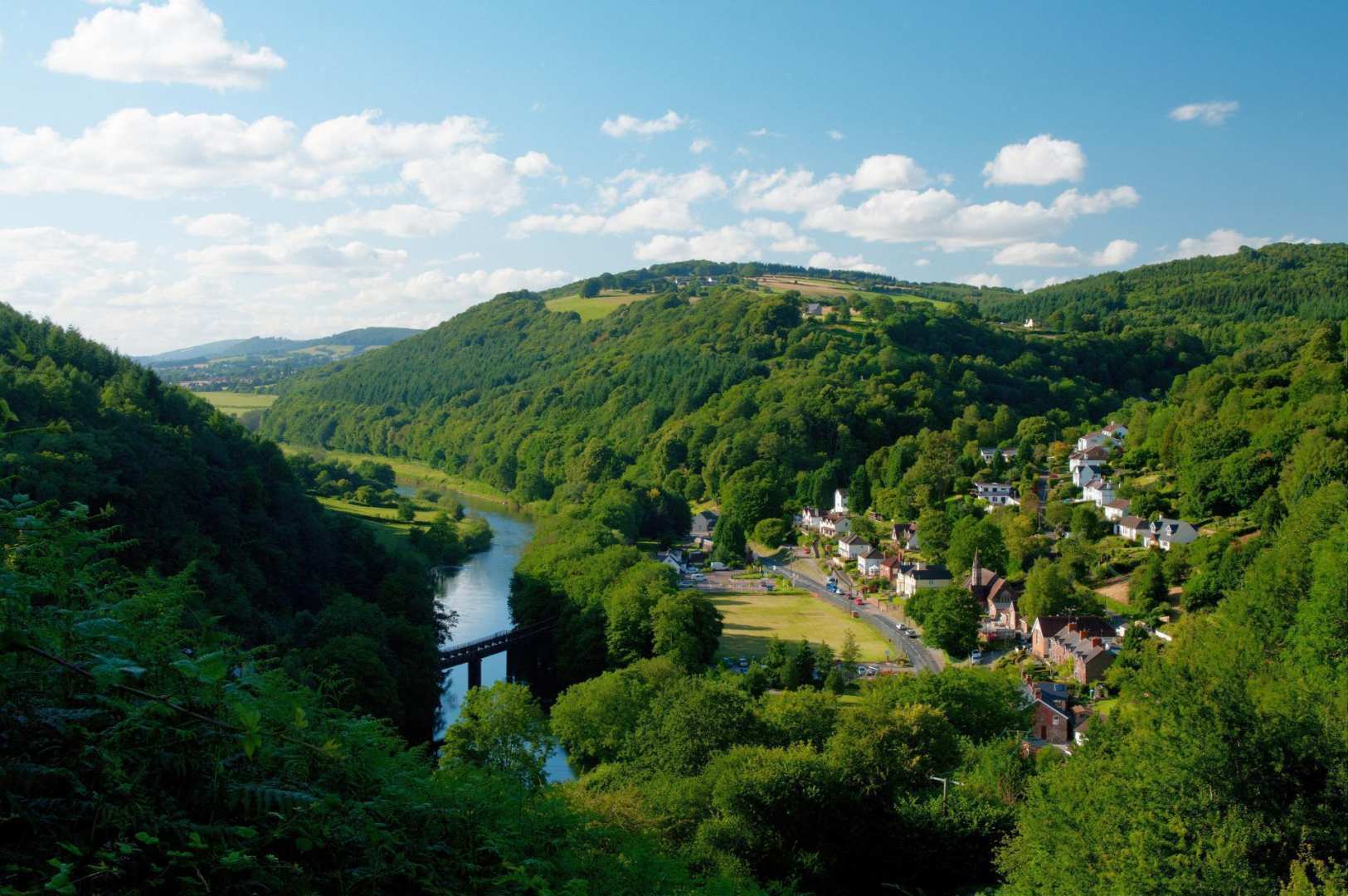
Heading towards Llangollen, you walk alongside the Llangollen canal briefly to reach Pontcysyllte Aquaduct - 'The Stream in the Sky'. The trail has two options here; either leave the canal and follow a road around, or walk over the Aquaduct. I'd highly recommend walking over the Aquaduct, although you will need a head for heights, as it is very high up above the River Dee, but you are rewarded with fantastic views. This area is a hive of activity with visitors and locals who live on the barges. The Aquaduct is only one boat wide, and as I arrived barges were queuing up to cross, as there was an armada of canoes and kayaks coming in the opposite direction.
.jpg) Leaving the aquaduct, you head up through Trevor Hall Woods to emerge onto Panorama Walk, high above the Dee Valley. There are fantastic views from here down into the Dee Valley and Llangollen, of Trevor Rocks above and also of Castell Dinas Bran, a medieval castle perched on top of a hill ahead. The castle is not on the trail, but it can be visited via a steep uphill path from Offa's Dyke Path.
Leaving the aquaduct, you head up through Trevor Hall Woods to emerge onto Panorama Walk, high above the Dee Valley. There are fantastic views from here down into the Dee Valley and Llangollen, of Trevor Rocks above and also of Castell Dinas Bran, a medieval castle perched on top of a hill ahead. The castle is not on the trail, but it can be visited via a steep uphill path from Offa's Dyke Path.
.jpg)
This section of walk was stunning; it was certainly my favourite section, and the sunny weather helped too. Leaving Panorama Walk, the trail joined a fantastic high level path, which traversed scree slopes under the impressive Eglwyseg Crags; it felt like I was walking in the Alps.
.jpg) Next came a lovely open moorland section across Cyrn-y-Brain, before heading into Llandelga Forest.
Next came a lovely open moorland section across Cyrn-y-Brain, before heading into Llandelga Forest.
.jpg) This is managed spruce forest, and is very different to the ancient woodland found in the Wye Valley. The forest was first planted in 1971/1972 and first harvested after around 40 years; most of the spruce being harvested is used to produce newsprint paper.
This is managed spruce forest, and is very different to the ancient woodland found in the Wye Valley. The forest was first planted in 1971/1972 and first harvested after around 40 years; most of the spruce being harvested is used to produce newsprint paper.
.jpg) It was definitely a very rewarding day of great contrasts!
It was definitely a very rewarding day of great contrasts!
Contours Holidays pride ourselves on our expert knowledge of the UK’s trails. We regularly set out to check our routes and directions and to make improvements on the holidays we offer. You can find several write-ups of staff expeditions in our Trail Diaries.
.png)
.jpg)