Best Man-made Landscape Walks in Cumbria
Explore Cumbria's reservoirs and overgrown quarries: unusually scenic proof of human life within the Lake District.
Best Man-made Landscape Walks in Cumbria
https://www.contours.co.uk/man-made-landscape-walks-cumbria
Cumbria is a county crammed full of all that is good in nature – glorious fells, majestic lakes and a vast array of wildlife – but some of our natural wonders aren’t quite as natural as they first appear. I love nature and wildlife and I also love history, so what better way to combine those two loves than by visiting some of our less natural, but just as beautiful, lakes and nature reserves.
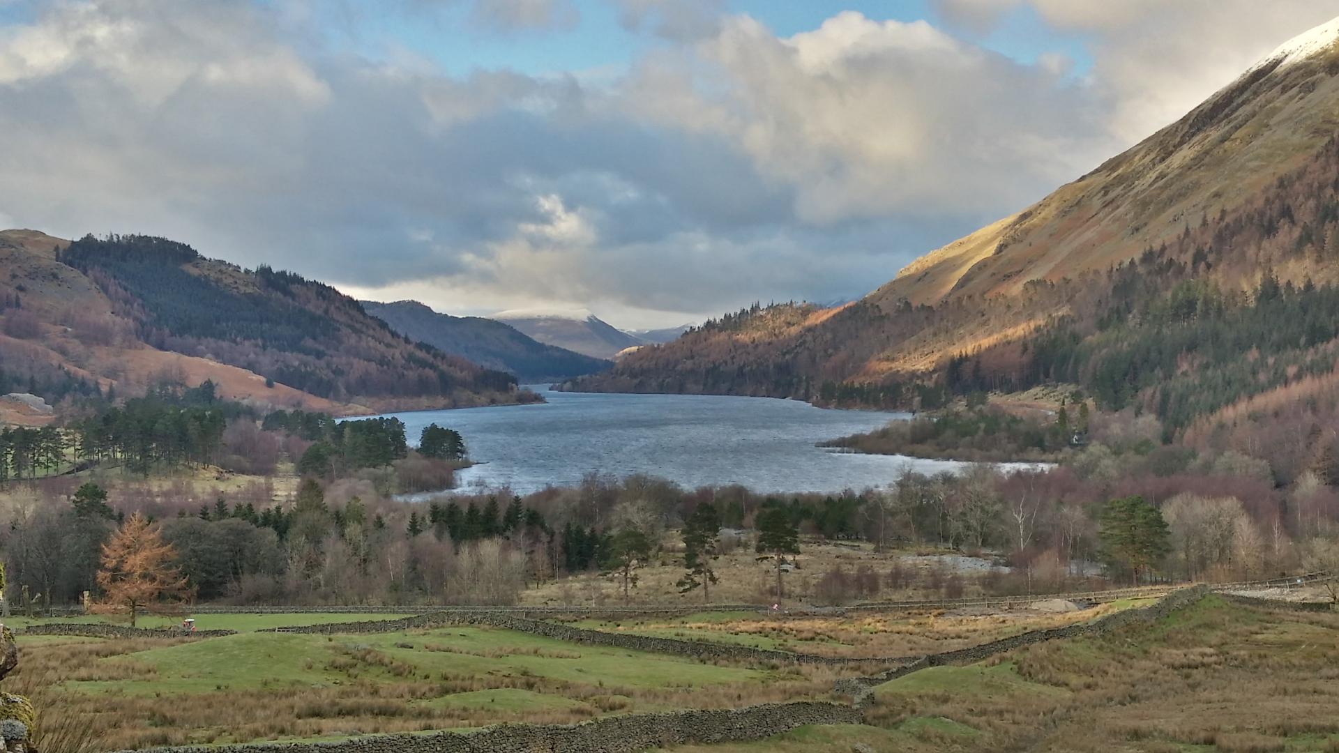
This is possibly the most famous reservoir in Cumbria, on account of the fact that every time we have a drought the water levels drop, revealing the ghostly remains of the village below. Mardale Green was by all accounts a beautiful settlement nestled peacefully at the head of Mardale Valley; these days it lies submerged beneath the waters of the reservoir, only peeking out occasionally during times of drought.
In 1919 the Manchester Corporation obtained an Act of Parliament allowing them to build a dam across the head of the valley to raise the water levels, thus creating the reservoir but losing the village of Mardale Green.
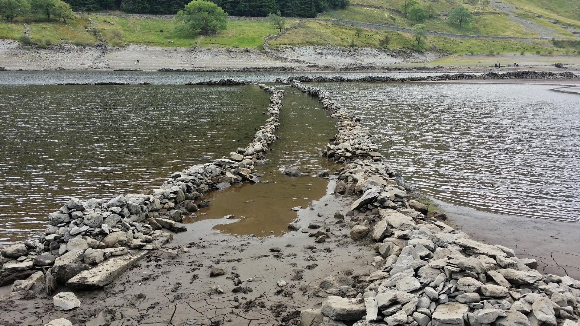
Whatever the weather, a walk around the banks of the reservoir is the ideal way to spend the day, with the very handily placed Haweswater Hotel as the perfect stopping point en route. There is plenty of wildlife to spot too, including red deer and adders, but the Golden Eagle who once lived here sadly died a few years ago.
Ties in perfectly with: Coast to Coast Walk
I love a stroll along the Kentmere valley up to the reservoir and there are plenty of examples of man making his mark on the landscape, from the quarries towards the top of the valley to the remains of a medieval village along the banks of the river. The reservoir at the head of the valley was constructed in 1845 to regulate the flow of the water along the valley which, at its peak, supplied 8 quarries and 7 watermills.
Further down the valley, and overlooked by most visitors, is Kentmere Tarn which, although it was originally a naturally formed glacial lake, has been mined and interfered with by man over many centuries.
During the 1840s the lake was drained and the land used for farming but, as it was still too swampy, it was soon abandoned. During the early 20th century the tarn was mined for Diatomite, a key ingredient of asbestos, and this accounts for the oddly shaped north end of the tarn.
Modern man wasn’t the first person to make use of the tarn though; over the years two Viking “dugout” boats have also been discovered hidden deep in the sediments.
Ties in perfectly with: Dales Way
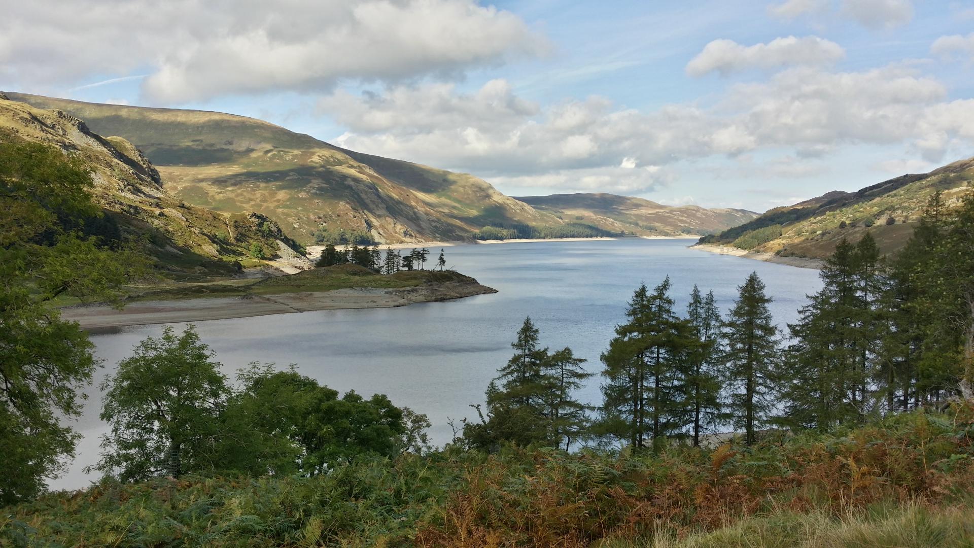
This is an absolute gem of a valley. By far the best viewing spot is from Raven Crag, high above the north end of the reservoir. If you check on your OS Map, you’ll spot a nice, long, slow ascent up through the woods around the back of the crag, or there’s the short, sharp, straight up through the woods approach underneath the crag for those with less patience and more energy. Either way, pack a picnic as you’ll want to hang around up there once you get there.
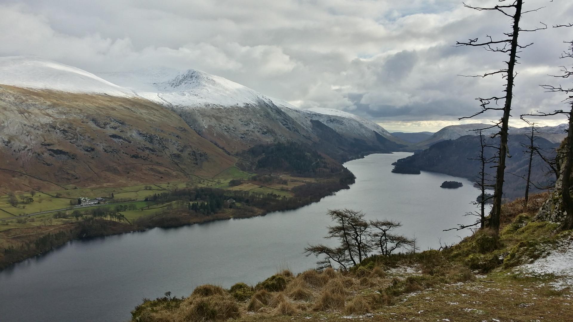
The current reservoir was once two small lakes separated by a very pretty bridge, known as the “Celtic Bridge” near Armboth, and the valley was a favourite haunt of Wordsworth and Coleridge. During the second half of the 19th century, the Manchester Corporation proposed flooding the valley to create the reservoir we see today. Their tactics were, at times, questionable and there was a huge amount of local resistance, but they eventually won and in June 1894 the dam was completed. The water is transported to Manchester (over 100 miles away) along the Thirlmere aqueduct using only the power of gravity. A fountain in Albert Square in Manchester marks the ceremonial end of the aqueduct.
Ties in perfectly with: Lakeland Round
Just outside Egremont, a mile or so along a wooded lane hides a wonderful secret garden. Not a garden in the formal sense, perhaps more of a secret oasis, or secret field might be a more appropriate way of describing it. Whichever description you prefer, there’s no denying that it’s hidden away.
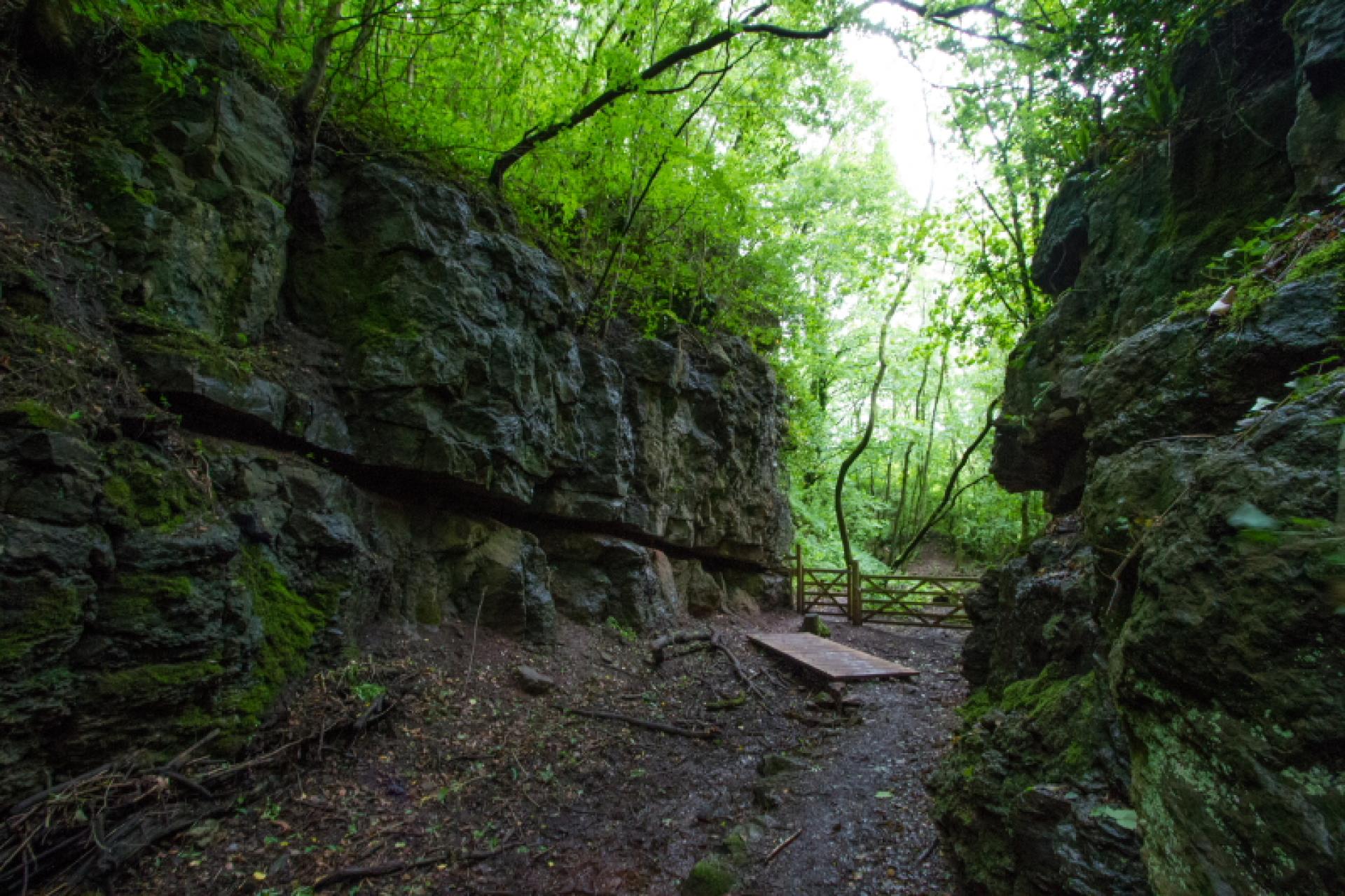
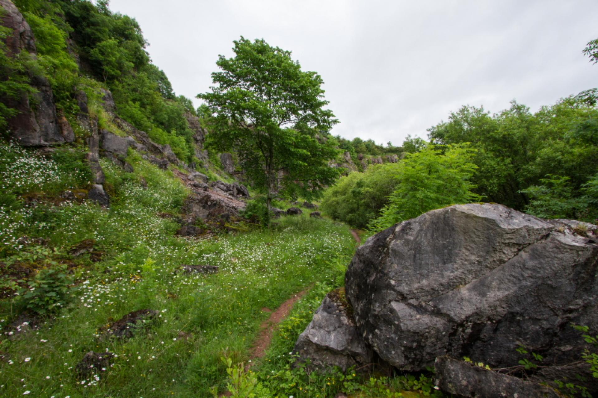
There are a couple of laybys near to the entrance with enough parking for several cars, and beyond the wooden gate the path drops down to a narrow gorge where rail tracks once ran out of the site; the first clues to the industrial history of this now tranquil site. From the 1600s right through until 1930 limestone was quarried here, but since then nature has been left to her own devices. The site is now owned and managed by Cumbria Wildlife Trust.
The path climbs through dense woodland before suddenly emerging into the bright daylight of the broad open quarry. The steep rock faces around the edges of the quarry are now largely covered by vegetation and coupled with the thick woods behind you, they give a real feeling of being cut off from the outside world. There’s an easy to follow route around the quarry and plenty of information boards to fill you in on the industrial past and a vast array of local wildlife to watch out for.
Ties in perfectly with: Coast to Coast Walk
This is only a very short walk, although there are plenty of ways to extend it into a circular walk through the nearby woods. Sandside is just along the Kent Estuary from Arnside and this tiny nature reserve, and rather lovely walk, follows a disused railway line which once ran from Arnside to Hincaster (near Kendal).
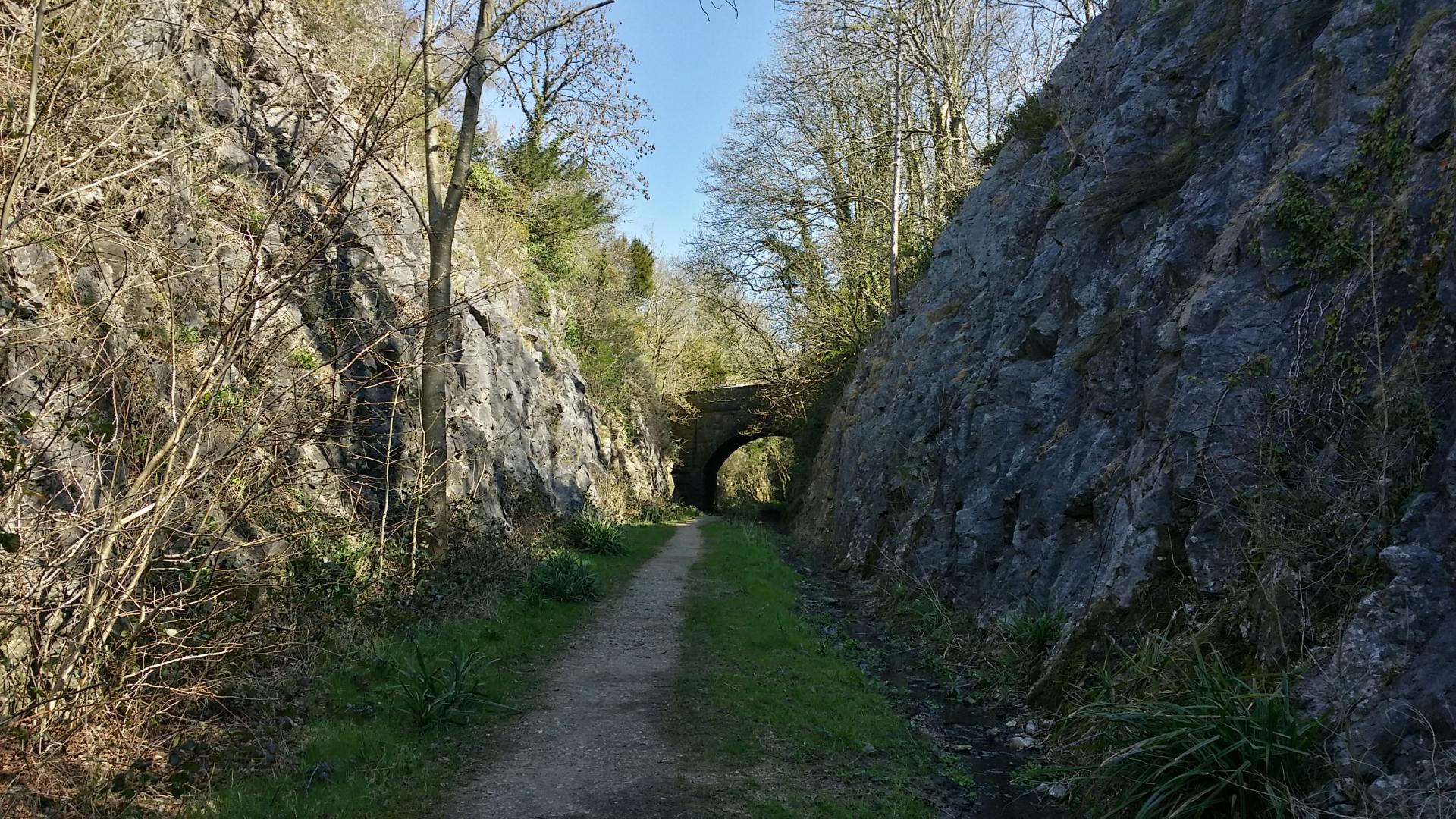
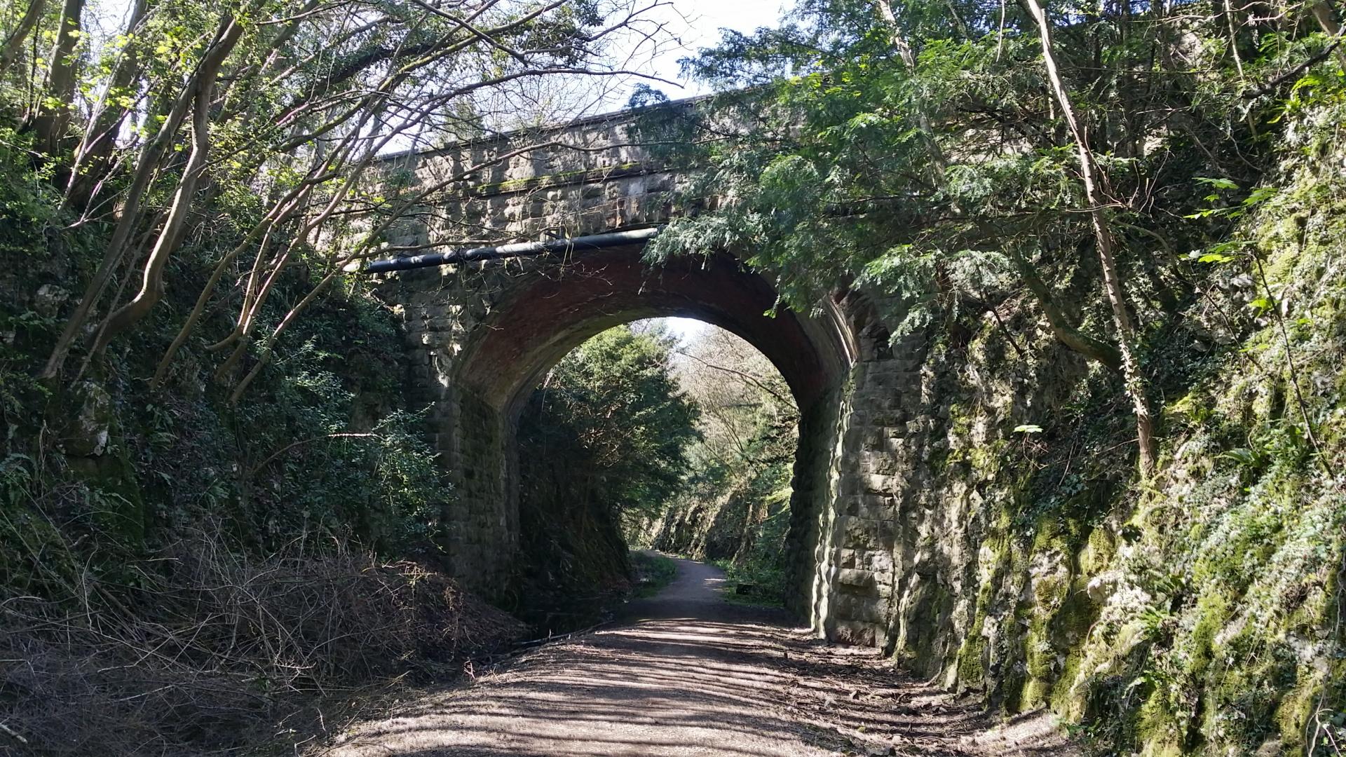
The line opened in 1876 and moved coal and iron ore coming in from County Durham across to the ironworks at Barrow-in-Furness, thus avoiding the busy junction at Carnforth. It also carried passengers between Kendal and Grange-over-Sands – a route that was known locally as the Kendal Tommy. The passenger route ended in 1942, with much of the tracks being removed in the 1960s, but a short stub from Sandside to Arnside continued to operate through until 1972, moving limestone from the local quarries.
There’s plenty of parking along the road at this point but do check out the local tide tables as, during particularly high tides, the road is prone to flooding.